Kuril Islands, 千島列島 1

Called the Kurils by Russia and the Northern Territories by Japan, a string of volcanic islands are at the heart of a feud between the two countries that has prevented them signing a formal World War II peace treaty.
Talks stalled for decades due to Japan‘s claim to the four strategic islands seized by the Soviet army in the final days of the war.
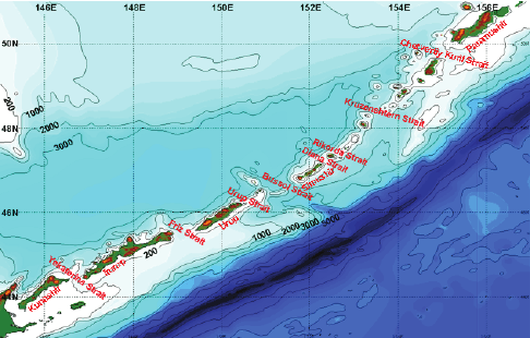
Map-of-the-Kuril-Islands
Map of the Kuril islands and adjacent Hokkaido and Kamchatka.
Modified from Wikimedia Commons.
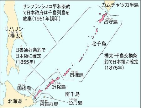
日ロ領土問題をめぐる主な動き
1875年 樺太・千島交換条約で日ロの国境が画定
1917年 ロシア革命
1922年 ソ連が成立
1945年 ヤルタ協定に基づき、ソ連が千島全域を軍事占領
1951年 サンフランシスコ平和条約で日本は千島を放棄
1956年 日ソ共同宣言で国交回復。日本は「4島返還」を打ち出す
1973年 田中角栄首相が訪ソ、日ソ共同声明を発表
1991年 ソ連が崩壊。領土問題はロシアに引き継がれる
2018年 日ロ首脳会談で日本が事実上、「2島返還」に後退
2020年 ロシア憲法改定、「領土割譲禁止」を盛り込む
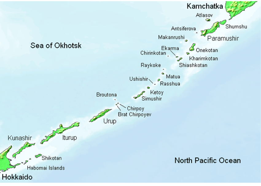
-最も北東にあるのが占守島 (しゅむしゅとう, Shumshu )で、
そこから南西方向に幌筵島(ぱらむしるとう, Paramushir )・温禰古丹島 おんねこたんとう. Onekotan )・
- 得撫島 (うるっぷとう, Urup) より南西にある
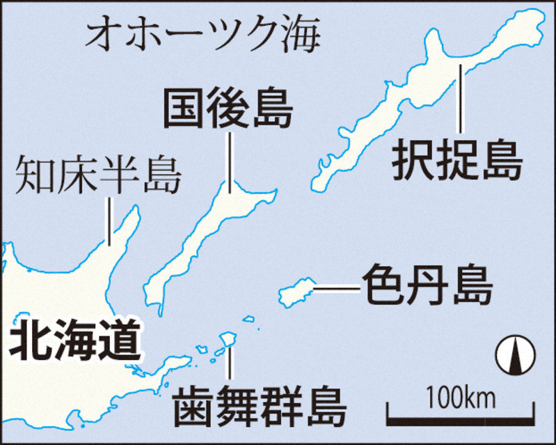
択捉島(Итуруп, えとろふとう, Iturup )・国後島(Кунашир, くなしりとう, Kunashir )・
色丹島(Шикотан, しこたんとう, Shikotan)および歯舞群島(Хабомаи, はぼまいぐんとう, Habomai / Khabomai )の4島(いわゆる北方四島または南クリル列島)
千島列島(クリル列島)は日本の北海道からロシアのカムチャツカ半島までの間に連なり、20以上の島々から構成される。北千島・中部千島・南千島に分けられる。また、小千島列島・大千島列島に分けられる。
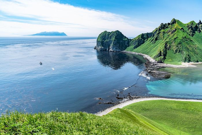
Ushishur( 宇志知島, うししるとう)
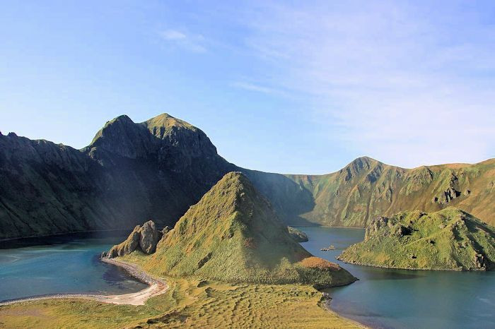
Intracaldera domes in Ushishur. Older domes in center of photo. Most recent domes to the right of center.
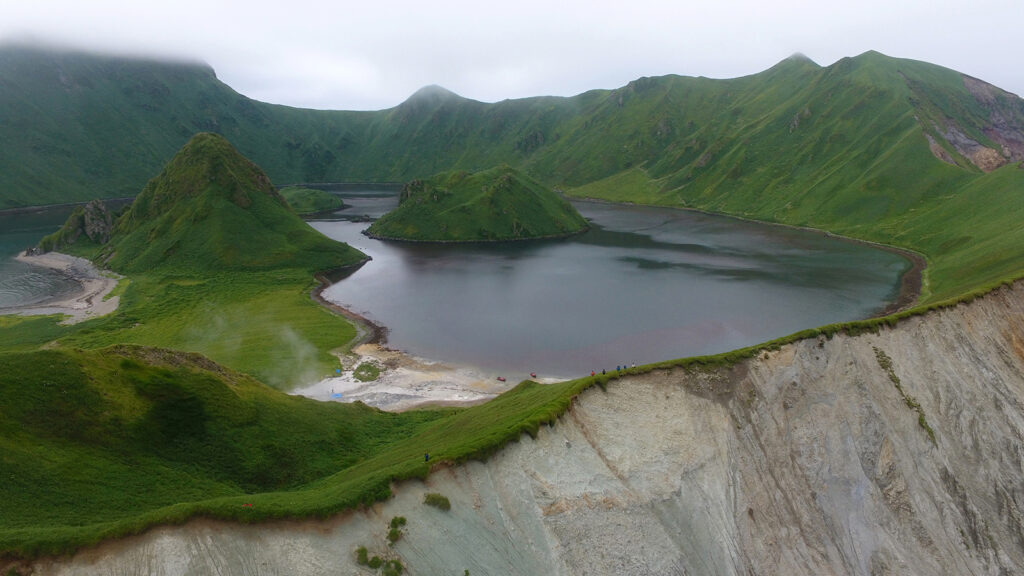
火山列島ならではの地形が広がる千島列島のウシシル島
화산 열도 특유의 지형이 펼쳐지는 치시마 열도의 ushishiru 섬
Ushishur (also spelled Ushishir) volcano is located in the central Kuril Islands. It is a small breached caldera with at least four domes since the caldera-forming eruption. The Ushishur Islands have Ushishur (also known as Yankich / Yankicha Island) and Reponkich Island to the north.
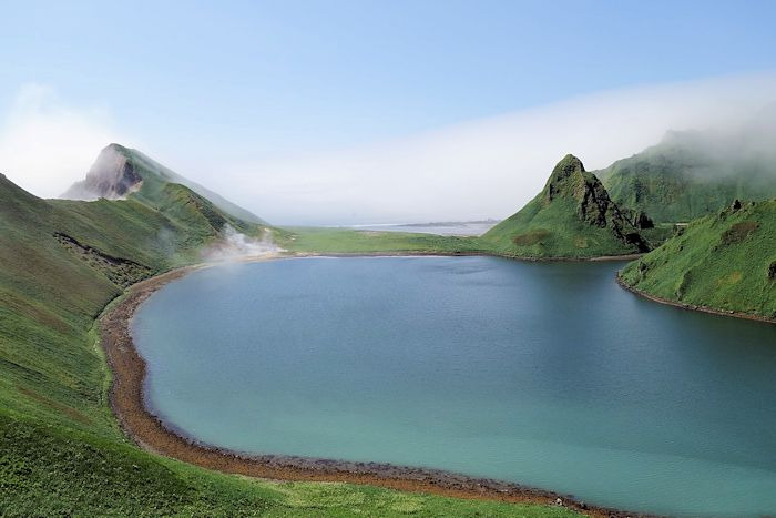
Ushishur volcano looking S. Active fumarole / thermal spring area is left of center. This area has an onshore and offshore component, with onshore component emitting steam.
entrance to the caldera.
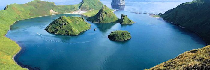
View from the rim of Ushishur Volcano looking across Kraternaya Bight. All 4 intra-caldera domes are visible as is the hydrothermal / fumarole area on the rim.
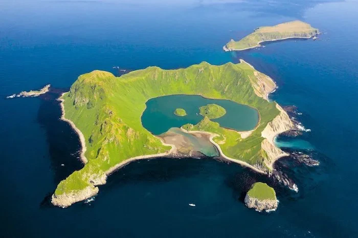
千島列島最高峰アライド山が聳えるアトラソヴァ島
アトラソヴァ島(阿頼度島, Atlasova 섬 )
千島列島最高峰アライド山(2,339m)
360度の絶景が広がるアライド山(2,339m)
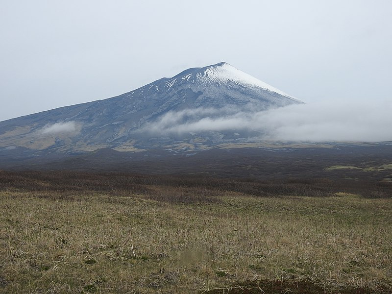
阿頼度島 阿頼度山 親子場山
阿頼度山(あらいどさん、英語表記:Alaid、ロシア語:Алаид)は、千島列島の阿頼度島にあり、同列島の中で最も高く、最北端にある火山である。 秀麗な形から、阿頼度富士とも呼ばれる。 別名:親子場山。 この左右対称の成層火山は、2,339メートルの高さを持ち、山頂は直径1.5キロメートルのカルデラを形成している。
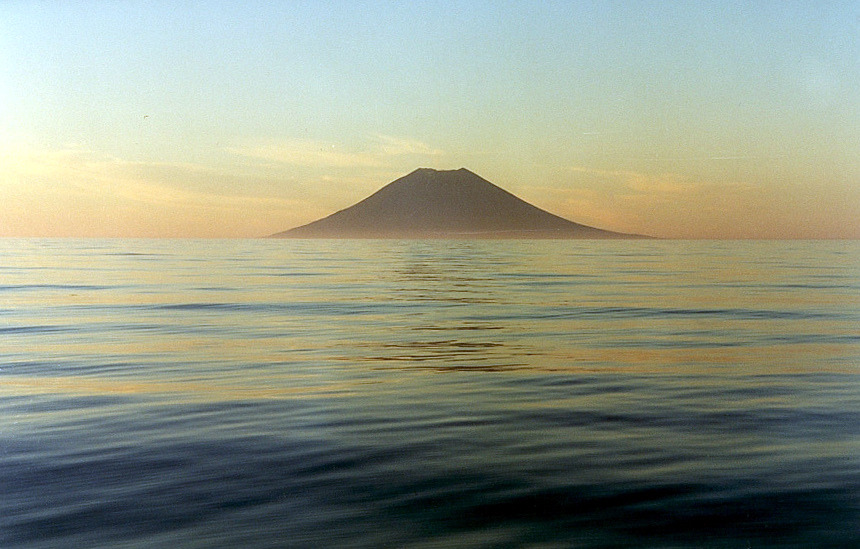
Atlasov island
海から望む阿頼度山