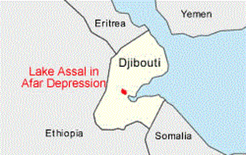
Lake Assal, Djibouti
Lake Assal
بحيرة عسل
بحيرة عسل (Arabic)
Buḥayrah ʿAsal (Arabic)
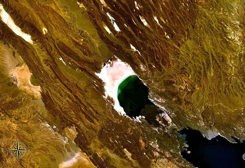
Lake Assal in Djibouti. Satellite view.
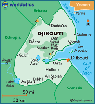
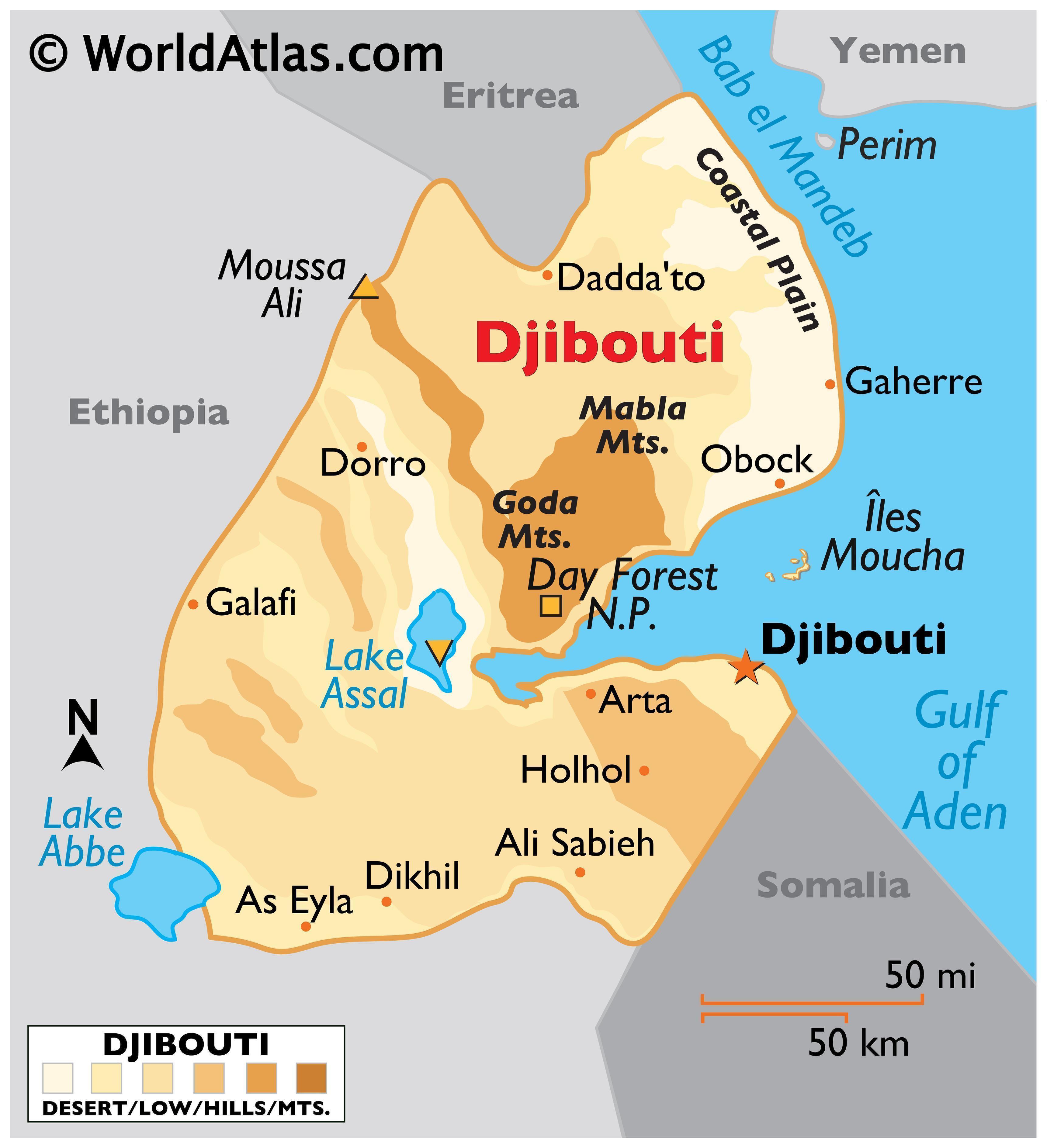
Location : Tadjourah Region
Basin countries : Djibouti
Max. length : 19 km (12 mi)
Max. width : 6.5 km (4.0 mi)
Max. depth : > 40 m (130 ft)
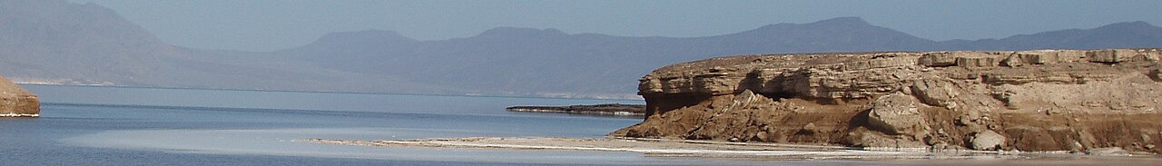
Lake Assal, Djibouti
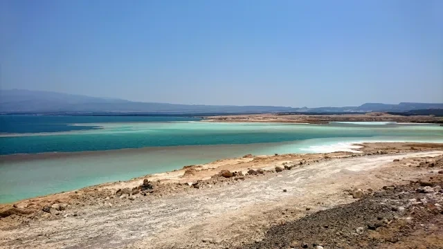
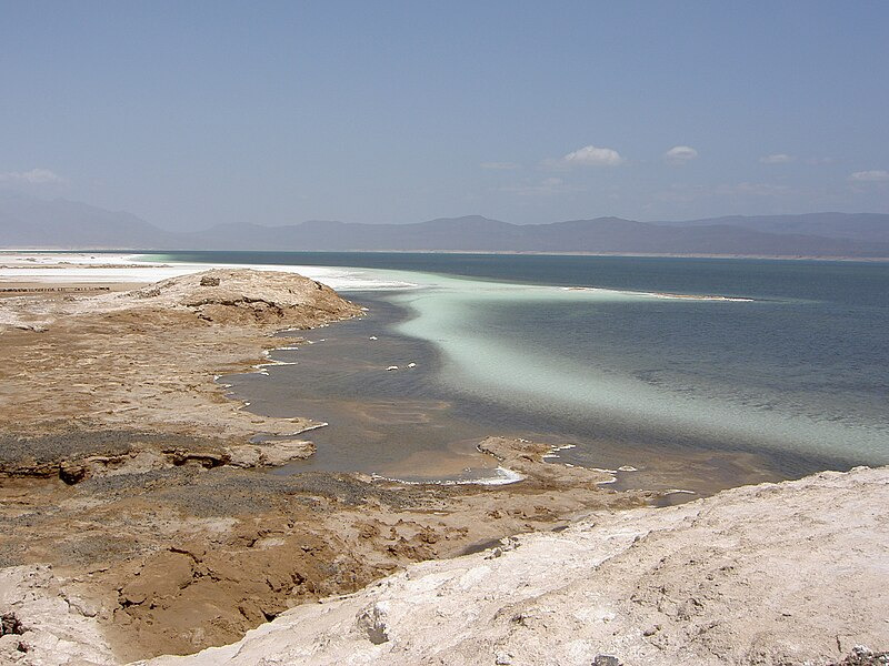
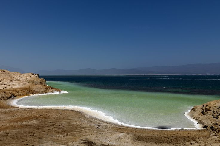
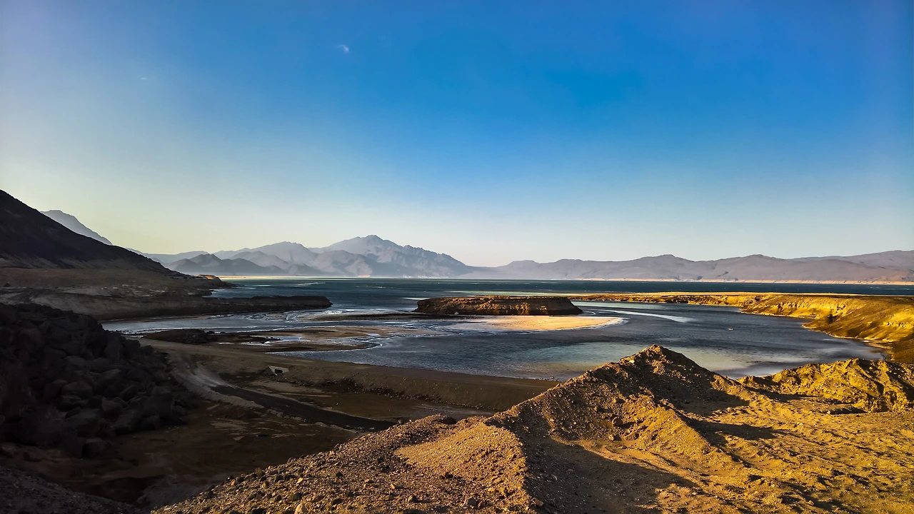
Lake Assal, with the salt pan on the left

Lac Assal | Djibouti Palace Kempinski
Lac Assal, Djibouti: the Salty Wonder in Africa’s Depths
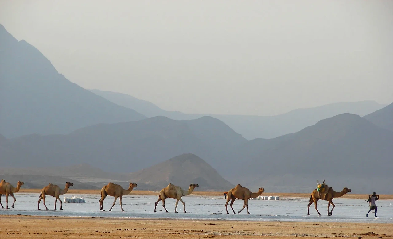
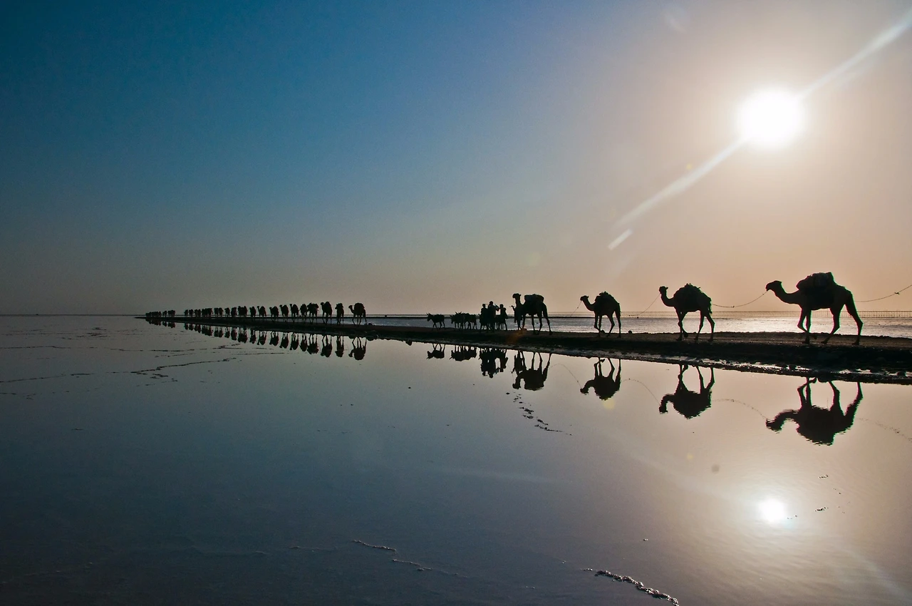
Camel-caravan-Lake-Assal-Djibouti
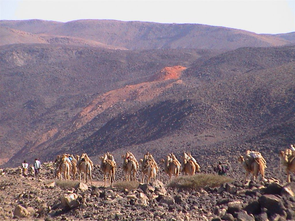
Lake Assal's caravan route
Map of Lake Assal, Djibouti

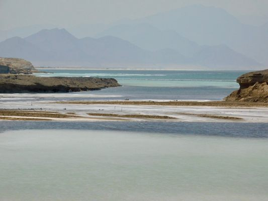
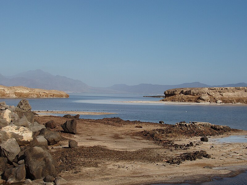
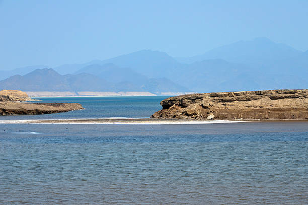
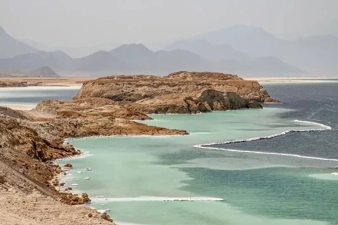
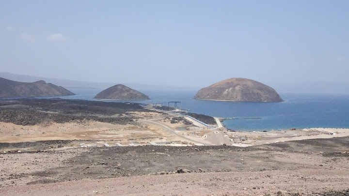
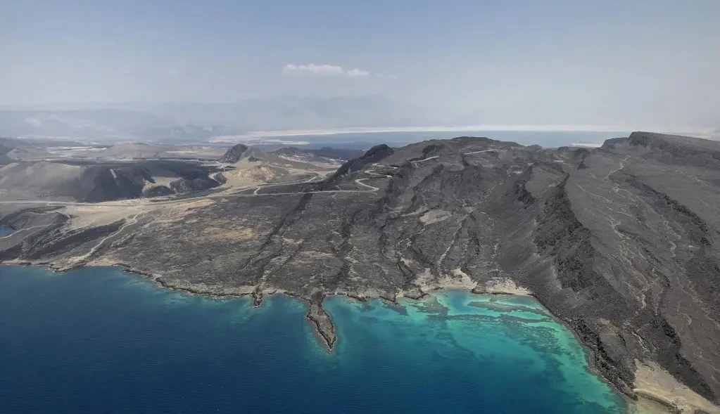
Ghoubbet-el-Kharab
Bay of Ghoubbet, sources of water to Lake Assal
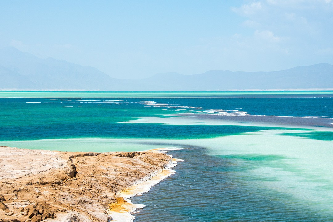
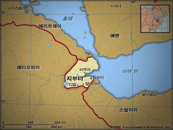
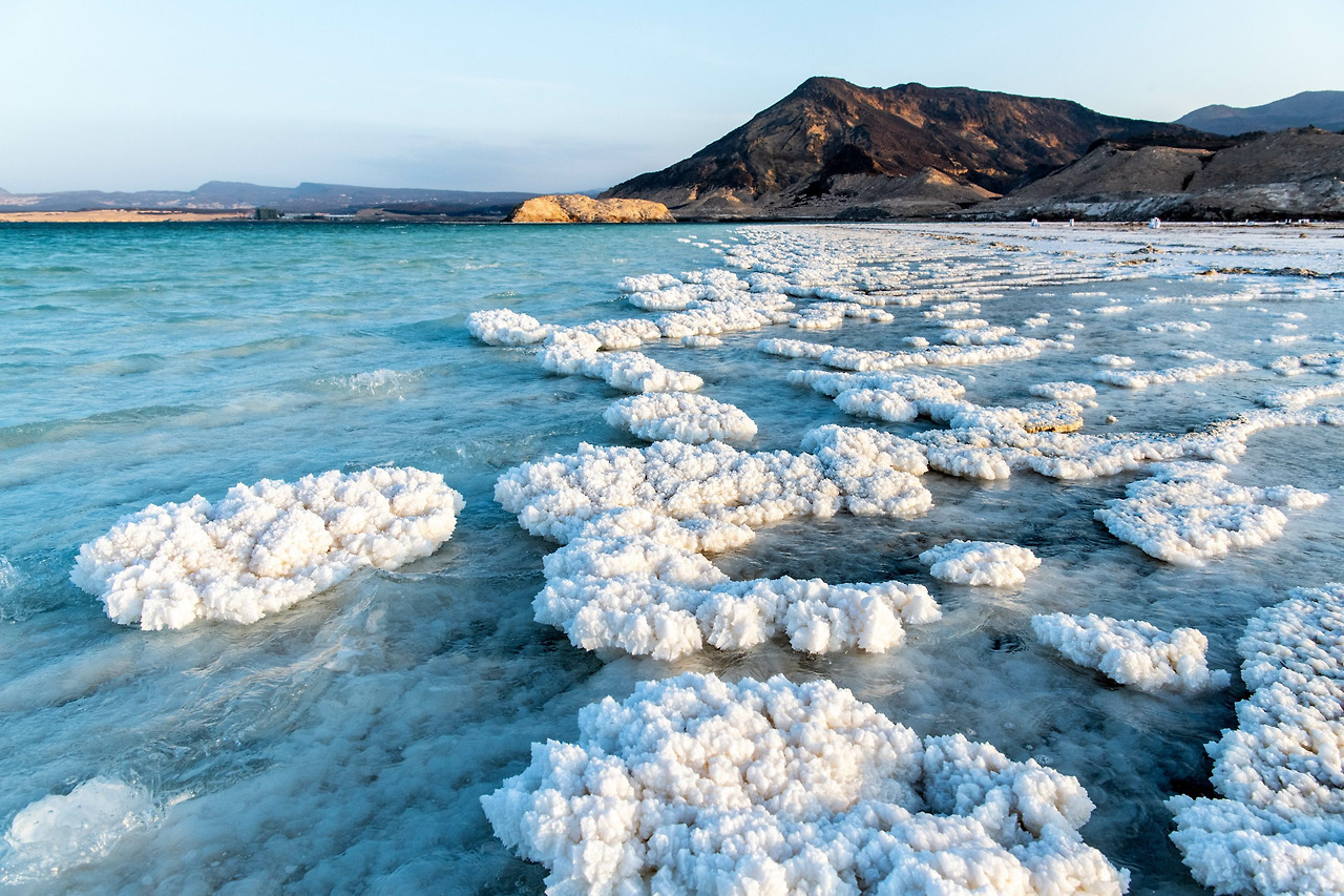
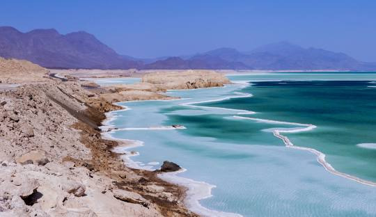
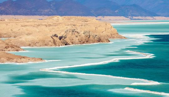
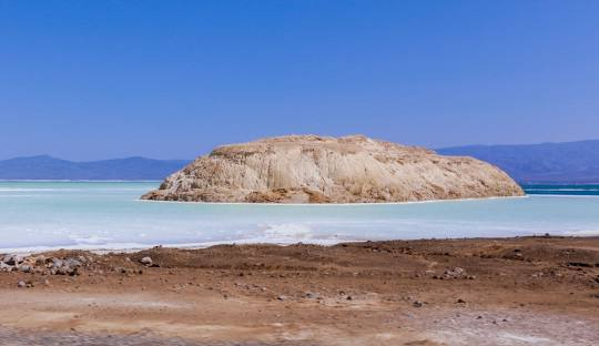
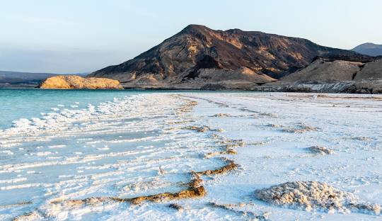
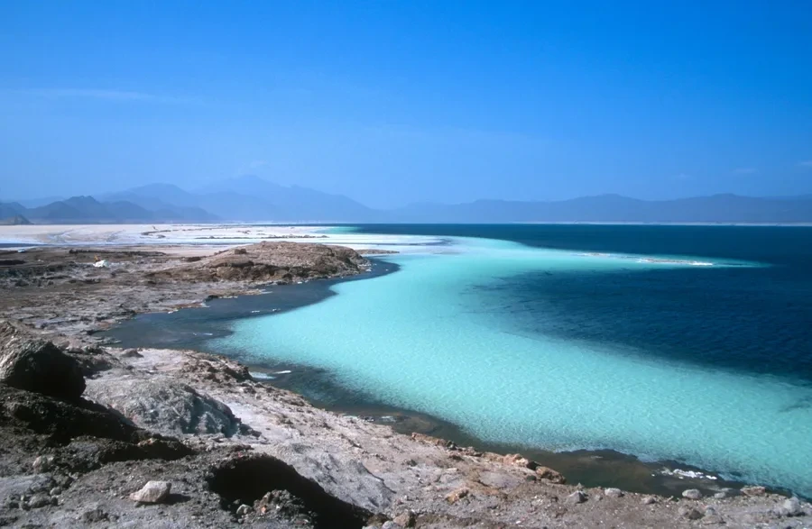
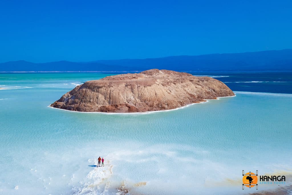
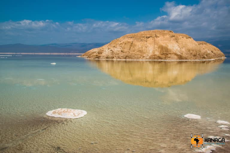
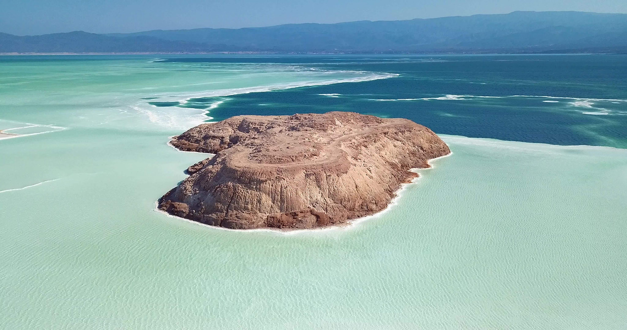
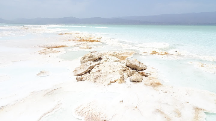
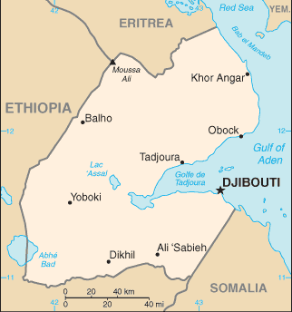
Lake Assal (Arabic: بحيرة عسل Buḥayrah ʿAsal, lit. “Honey Lake”) is a crater lake in central-western Djibouti. It is located at the western end of Gulf of Tadjoura between Arta Region, and Tadjoura Region, touching Dikhil Region, at the top of the Great Rift Valley, some 120 km (75 mi) west of Djibouti city. Lake Assal is a saline lake that lies 155 m (509 ft) below sea level in the Afar Triangle, making it the lowest point on land in Africa and the third-lowest point on Earth after the Sea of Galilee and the Dead Sea. No outflow occurs from the lake, and due to high evaporation, the salinity level of its waters is 10 times that of the sea, making it the fifth most saline body of water in the world, behind Garabogazköl, Lake Retba, and Gaet'ale Pond. The salt in the lake is exploited under four concessions awarded in 2002 at the southeast end of the lake; the major share of production (nearly 80%) is held by Société d’Exploitation du Lac and Société d’Exploitation du Salt Investment S.A de Djibouti.
The lake is a protected zone under Djibouti's National Environmental Action Plan of 2000. However, the law does not define the boundary limits of the lake. Since the exploitation of the salt from the lake was uncontrolled, the Plan has emphasized the need for managing the exploitation to avoid negative impact on the lake environment. The Government of Djibouti has initiated a proposal with UNESCO to declare the Lake Assal zone and the Ardoukoba volcano as a World Heritage Site.

Afar Salt Miners
Lake Assal, Djibouti

Sand pans extracted by industrial process


Aerial-view-to-the-Saline-Lake-Assal-in-Tadjoura-region-Djibouti
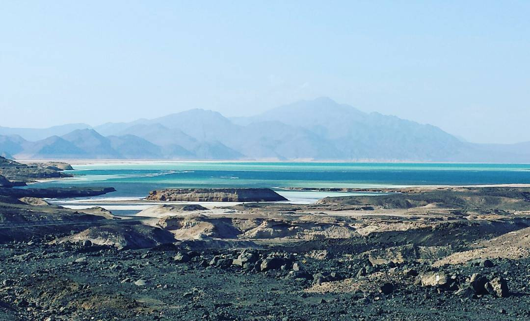
Lake Assal is located in the lowest depression in the whole of Africa, at 155 metres below sea level, which is the lowest point in Africa and the third lowest point on Earth after the Sea of Galilee and the Dead Sea.
Lake Assal, Djibouti

Lake Assal, Djibouti
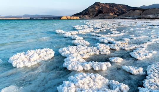
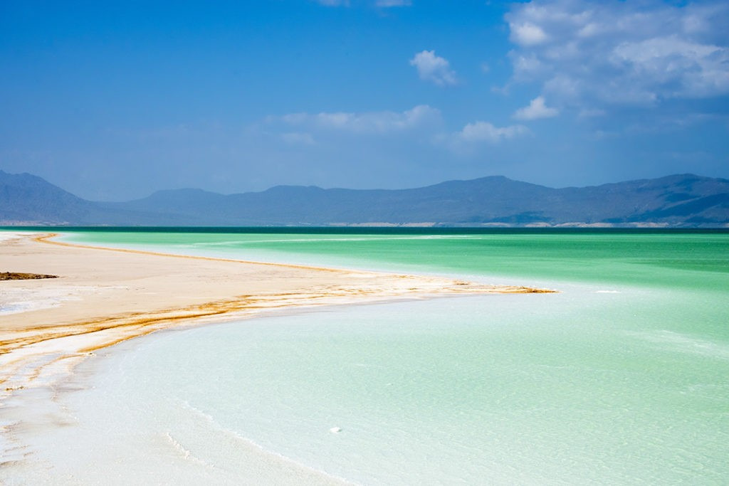
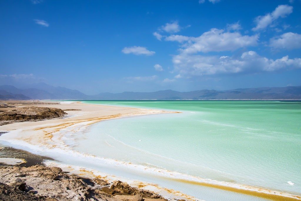
Its name means 'honey' in Arabic, but the waters of this Djibouti lake are far from sweet. Rapid evaporation here in the desert, combined with a lack of outflow, give Lake Assal a salinity level as high as 40%—ten times as salty as the ocean. Assal is even saltier than the Dead Sea and almost as low-lying: its surface more than 500 feet below sea level, it's the lowest-elevation point in Africa.

Aerial View to the Saline Lake Assal in Tadjoura Region, Djibouti Pro Video
Djibouti - Down to the lowest point in Africa
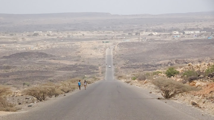
This country is the third smallest country in Africa, but almost all of it is desert.
There are no rivers, only salt lakes in the desert.
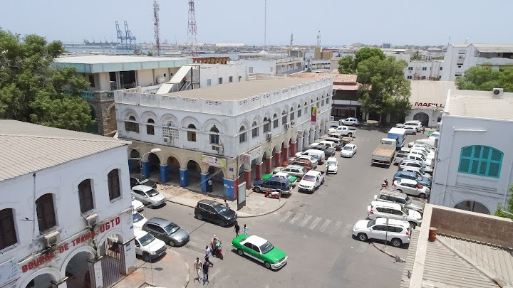
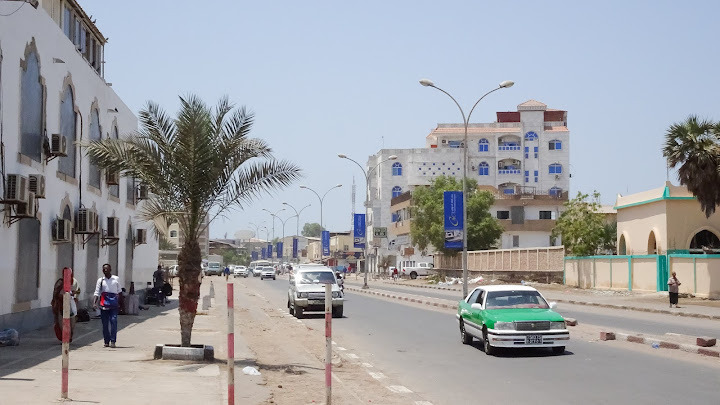
Djibouti City downtown, the capital.

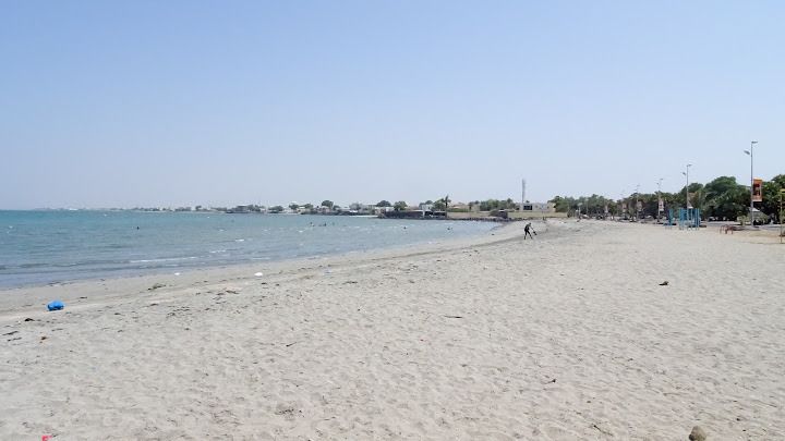
Beach of Djibouti

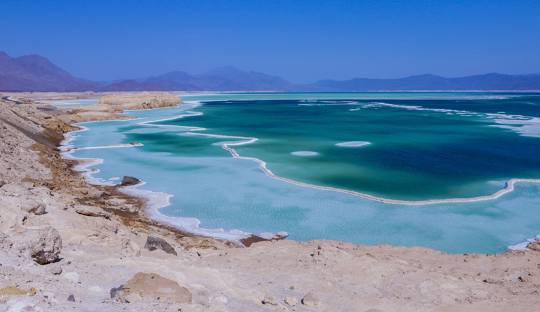
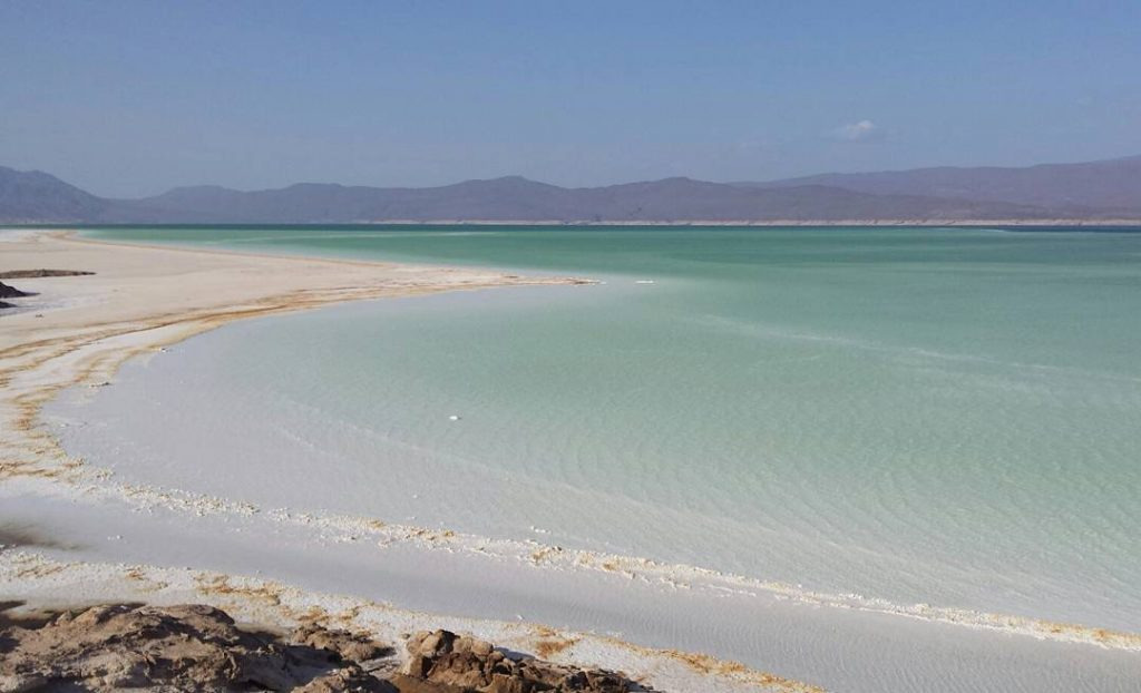
Lake Assal’s crystalline beauty
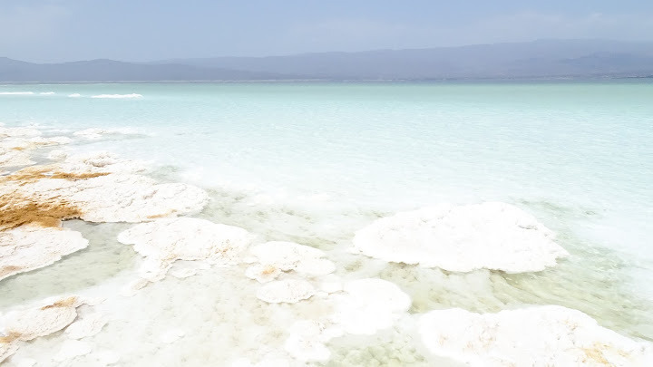

The bright white salty lake - Lake Assal
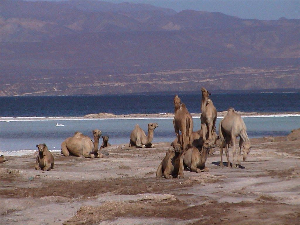
Camels at Lake Assal, Djibouti
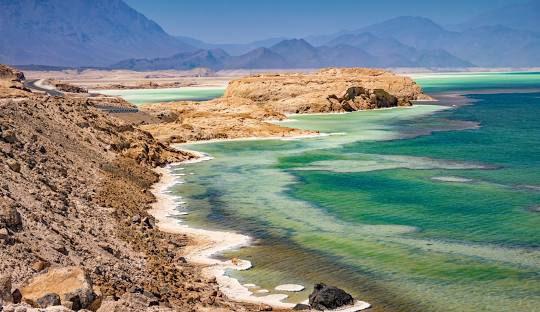
Djibouti, Lake Assal and Tadjoura
Panorama-of-Crater-salt-lake-Assal-Djibouti
Djibouti: Floating at the lowest point in Africa!
Dikhil, 155m below sea level and the lowest point on the African continent!
The contrast of the salt against the bright blue is striking and it was really fun to float in the lake.
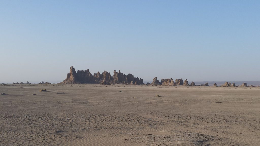
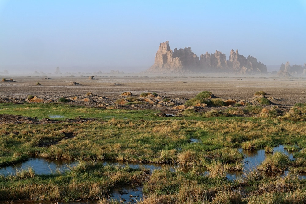
Lac Abbe is a plain dotted with limestone chimneys, some as high as 50m.
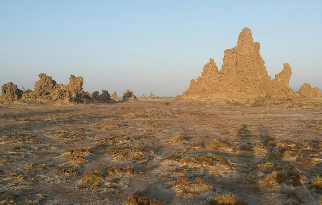

Sunset over Lac Abbe
Salt of the earth: Lac Assal in Djibouti
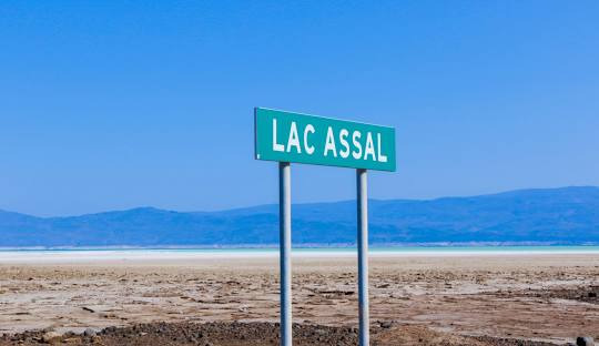
Lac 'Assal
Lake Assal | Lowest Point in Africa, Location, Country, & Continent | Britannica
Lake Assal, Saline lake, central Djibouti. Situated at 509 ft (155 m) below sea level, it is the lowest point in Africa. It has been used for quarrying
www.britannica.com
Lake Assal (Arabic: بحيرة عسل Buḥayrah ʿAsal, lit. “Honey Lake”) is a crater lake in central-western Djibouti.
Lake Assal (Arabic: بحيرة عسل Buḥayrah ʿAsal, lit. “Honey Lake”) is a crater lake in central-western Djibouti. It is located at the western end of Gulf of Tadjoura between Arta Region, and Tadjoura Region, touching Dikhil Region, at the top of the Great Rift Valley, some 120 km (75 mi) west of Djibouti city.
아살호(아랍어: بحيرة عسل, 직역: 꿀 호수)는 중서부 지부티에 있는 화구호다. 이곳은 지부티 시로부터 약 120km 떨어져 있는 타주라 만의 서쪽 끝 부분에 위치하고 있으며, 이 만은 북쪽으로 타주라 주, 남동쪽으로 아르타 주, 그리고 남서쪽으로 디킬 주에 둘러싸여 있다.
염호인 아살 오후는 아파 삼각지대의 해수면보다 155m(509피트) 아래에 위치하는데 이는 아프리카에서 육지상 가장 낮은 지점이자 사해와 갈릴리 호에 이어 지구상에서 세 번째로 낮은 지점이다. 높은 증발량과 함께 물의 유출이 없기 때문에 아살호의 염분은 바다보다 10배에 달하는데, 이는 돈 후안 연못(아랍어: Don Juan Pond)과 개탈래 연못(아랍어: Gaet'ale Pond)에 이어 세계에서 세 번째로 높은 수치이다.
홍해의 출입구인 좁은 해협을 사이에 두고 예멘과 마주보고 있다.
아프리카의 뿔 아덴만 기슭에 있는 공화국이다. 국토 면적은 약 23,200㎢으로 이는 대한민국 수도권의 약 2배에 해당하는 크기이다. 작은 국토 크기에도 불구하고 홍해에서 인도양으로 넘어가는 길목에 위치한 탓에 예로부터 지리적으로 중요한 곳으로 인식되어 왔다.
평면상의 지형은 쿠웨이트와 비슷하며, 소말리아, 에티오피아, 에리트레아와 국경을 접한다.
전 국토가 사막이나 스텝 지대이고, 수도는 국명과 같은 지부티로 이 곳에 지부티 인구의 60% 가량이 거주한다.
이사족과 아파르족이 양대 민족을 이루고 있는 다민족 국가이다. 공용어는 기본적으로 이슬람권 국가이기에 아랍어와 프랑스 식민 지배의 영향으로 프랑스어이다.
국명은 "다우선이 도착한다" 라는 아랍어에서 유래했는데 과거에 항구 역할을 한 특성을 반영한다.
아프리카의 뿔
영어 : Horn of Africa 암하라어 : የአፍሪካ ቀንድ 소말리어 : Geeska Afrika 아랍어
namu.wiki
프랑스군이 주둔하는 효과 탓인지 주변 국가들인 예멘, 소말리아, 에티오피아, 에리트레아에 비하면 그나마 안정된 편이다. 21세기 들어선 미군도 아덴 만 소말리아 해적 문제로 일부 주둔하고 있으며, 그 외 유럽국가들과 중국, 일본 등 동아시아 국가들의 군대도 이 곳에 주둔하고 있다.
지부티의 주요 산업은 프랑스 및 여러 국가들의 주둔군과 관련된 파생 산업에서 나오며 그 외에는 항구를 이용한 수출입 산업이 있다.
HYMNE NATIONAL DJIBOUTI/ NATIONAL ANTHEM
https://www.youtube.com/watch?v=ZE7PjePYJig
|
소말리어 가사
|
아파르어 가사
|
한국어 해석
|
|
Hinjinne u sara kasa
Calankaan harraad iyo Haydaar u mudateen (x2) Hir cagaarku qariyayiyo Habkay samadu tahayoo Xiddig dhi igleh hoorshoo Caddaan lagu hadheeyaay Maxaa haybad kugu yaal (x4) |
Soolisnuh inkih solaa
Simbiliiy kah ningicle Bakaarat kah sugunne! (x2) Bulci kaak qaran sido. Way gubi kak anxar lusa! Cutukti caxte caydu Qidi wagri silaalo! Faylay heebati kumuu (x4) |
힘차게 일어나라! 우리의 깃발을 높이 올리기 위해
깃발엔 어떤 이의 값진 노고와 갈증과 극단의 고통도 함께 있으리라! (x2) 우리의 깃발, 그의 색상은 지구의 영원한 녹색을 뜻하며 파란 하늘, 하얀색, 평화의 색이로다 중앙의 붉은 별은 피를 뜻하는 것이다 오 우리들의 깃발이여, 이 얼마나 보기에 영광스러운가! (x4) |