Breathtaking view of the famous Fernando de Noronha
Breathtaking view of the famous Fernando de Noronha islands in Brazil
Fernando de Noronha
State district
State District of Fernando de Noronha
Fernando de Noronha
[də nəróunjə]
페르난두 데 누로냐
페르난두 데 누로냐: 브라질 본토 동쪽의 대서양에 있는 화산도; 연방 직할지.
Breathtaking view of the famous Fernando de Noronha islands in Brazil

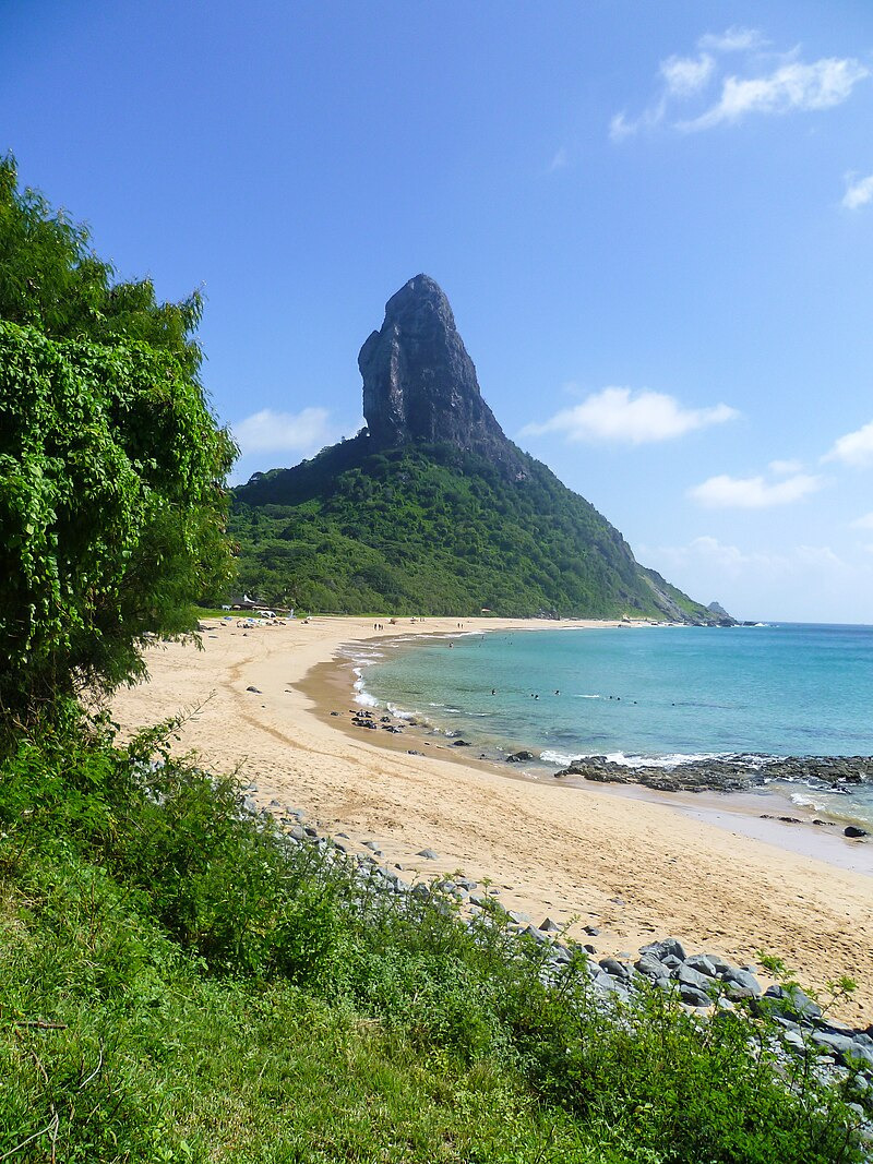
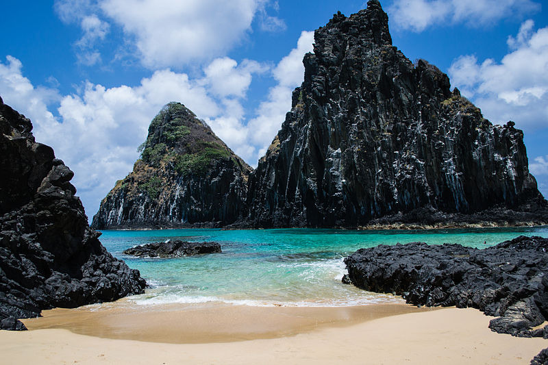
Morro Dois Irmãos
Two Brothers Rock - Fernando de Noronha Archipelago, Pernambuco, Brazil
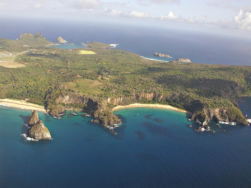
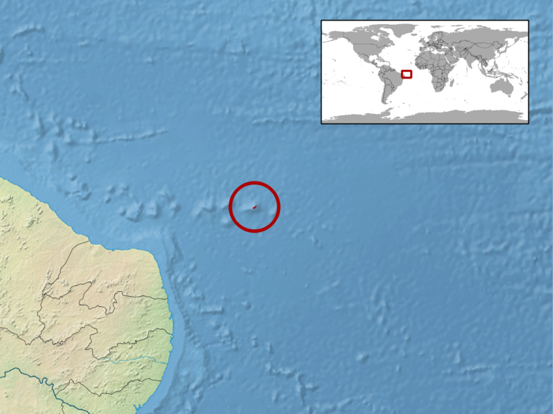
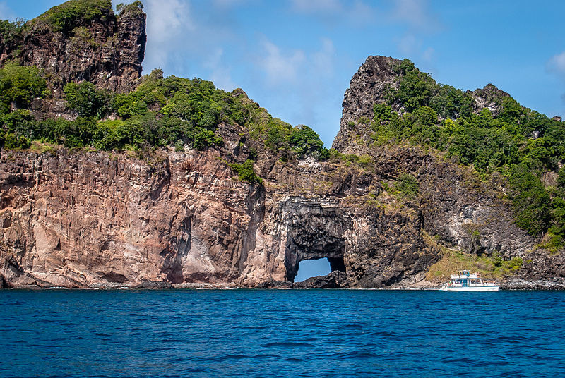
Fernando de Noronha (Brazilian Portuguese pronunciation: [feʁˈnɐ̃du dʒi noˈɾoɲɐ]), officially the State District of Fernando de Noronha (Portuguese: Distrito Estadual de Fernando de Noronha) and formerly known as the Territory of Fernando de Noronha (Território de Fernando de Noronha) until 1988, is an archipelago in the Atlantic Ocean, part of the State of Pernambuco, Brazil, and located 354 km (191 nmi; 220 mi) off the Brazilian coast. It consists of 21 islands and islets, extending over an area of 26 km2 (10 sq mi). Only the eponymous main island is inhabited; it has an area of 18.4 km2 (7.1 sq mi) and a population estimated at 3,101 in 2020. While most of the archipelago is relatively low-lying, there are parts reaching more than 100 m (328 ft) in elevation.
The islands are administratively unique in Brazil. They form a "state district" (distrito estadual) that is administered directly by the government of the state of Pernambuco (despite being geographically closer to the state of Rio Grande do Norte).[3] The state district's jurisdiction also includes the very remote Saint Peter and Saint Paul Archipelago, located 625 km (337 nmi; 388 mi) northeast of Fernando de Noronha. Seventy percent of the islands' area was established in 1988 as a national marine park.
In 2001, UNESCO designated it as a World Heritage Site because of its importance as a feeding ground for tuna, sharks, sea turtles, and marine mammals.[4] Its time zone is UTC−02:00 all year round.

Map_of_Fernando_de_Noronha-en.svg
Map of the Archipelago
The main island,
Fernando de Noronha
Fort of Nossa Senhora dos Remédios

Noronha
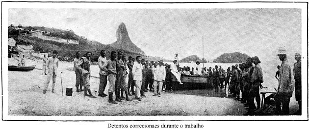
Island prisoners in 1930.
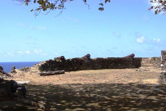
Ruins of Fort Santana

A U.S. military base in Fernando de Noronha, 1959

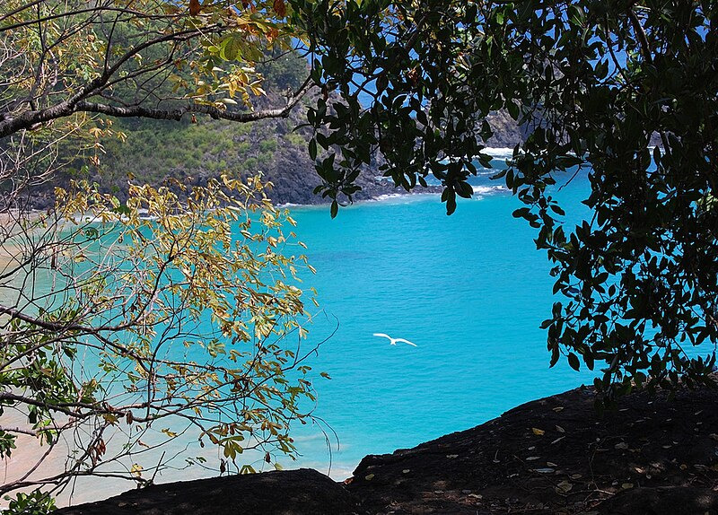
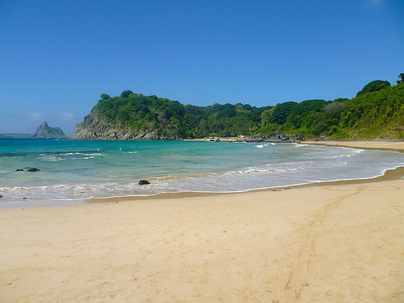
Sancho Bay-Fernando de Noronha
Discovery

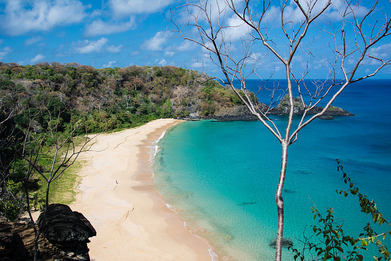
The main island
Morro Dois Irmãos
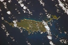
Satellite picture of Fernando de Noronha
Fernando de Noronha's occupation dates to the early 16th century. Due to its geographical position, the archipelago was one of the first lands sighted in the New World, being shown in a nautical chart in 1500 by the Spanish cartographer Juan de La Cosa, and in 1502 by the Portuguese Alberto Cantino, in the latter with the name "Quaresma".
Based on the written record, Fernando de Noronha island was discovered on August 10, 1503, by a Portuguese expedition, organized and financed by a private commercial consortium headed by the Lisbon merchant Fernão de Loronha.
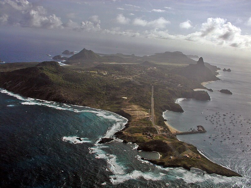
Nowadays, Fernando de Noronha Airport is served by daily flights from Recife and Natal on the Brazilian coast.
In 1988, Brazil designated approximately 70% of the archipelago as a maritime national park, with the goal of preserving the land and sea environment. On October 5, 1988, the Federal Territory was dissolved and added to the state of Pernambuco (except Rocas Atoll, which was added to the state of Rio Grande do Norte).
Today Fernando de Noronha's economy depends on tourism, restricted by the limitations of its delicate ecosystem. In addition to the historical interest noted above, the archipelago has been the subject of the attention of various scientists dedicated to the study of its flora, fauna, geology, etc. The jurisdiction is considered to be a separate "entity" by the DX Century Club, and so is visited rather often by amateur radio operators.
In 2001, the United Nations Educational, Scientific and Cultural Organization (UNESCO) declared Fernando de Noronha, with Rocas Atoll, a World Heritage Site. It cited the following reasons:
a) the island's importance as a feeding ground for several species, including tuna, billfish, cetaceans, sharks, and marine turtles,
b) a high population of resident spinner dolphins and
c) protection for endangered species, such as the hawksbill sea turtle (critically endangered) and various birds.
The island is served by Governador Carlos Wilson Airport with regular flights to Natal and Recife.
Fernando de Noronha Conceição beach Insel Strand

Cachorro Beach
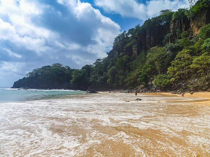
Landscape in Fernando de Noronha

Canhão-antiga proteção de Fernando de Noronha
Historic fortifications

Fernando de Noronha - dois Irmãos - praia dosancho
Aerial view
Fernando de Noronha Insel Strand

Crystalline water

Baia do Sancho - Sub Aquatica
Underwater
Sancho Bay, Baia do Sancho

Spinner dolphins in Dolphin Bay, Baia dos Golfinhos

Two Brothers Rock (Morro Dois Irmãos)
Cacimba do Padre
Two Brothers Rock - Fernando de Noronha Archipelago, Pernambuco, Brazil

Cacimba do Padre Beach, Fernando de Noronhaa
Ponta da Sapata
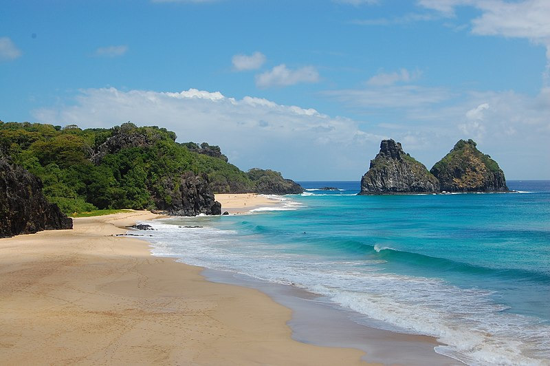
Two Brothers Rock
Morro dos Irmão, Fernando de Noronha, Brasil.

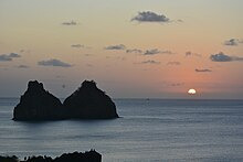
Sunset
Linha guia natural
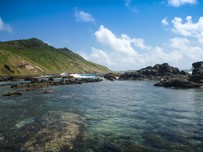
Fernando de Noronha snorkeling
Fernando_de_Noronha_Naturpool
Fernando de Noronha beach Sancho Bay
Fernando de Noronha Strand Baia do Sancho