2024. 10. 14. 05:38ㆍWonderful World
15 MOST Unbelievable Rock Formations From Earth's Past
https://www.youtube.com/watch?v=fgGue-5zIr8
Aug 11, 2024
15 Unbelievable Rock Formations. Across our planet, rock formations bear witness to the relentless forces of erosion, weathering, and tectonic activity that have molded the Earth across millions of years. While many blend seamlessly into the landscape, others break the mold with their strange and unusual appearances. These extraordinary geological marvels not only captivate travelers and nature enthusiasts but also tell the profound story of Earth's dynamic past. Prepare to be amazed as we journey to the far corners of the globe, unveiling nature's most extraordinary masterpieces in our exploration of the fifteen most Unbelievable Rock Formations..
The Ultimate Discovery creates unique transformative content for educational and entertainment purposes and represents the opinions of this channel. If you believe your copyright has been violated please contact us directly theultimatediscovery1@gmail.com. We take out content seriously and all content meets legal standards for licensing or fair use. Any attempts to falsify content strikes via the YouTube copyright system will be dealt with by our legal team.
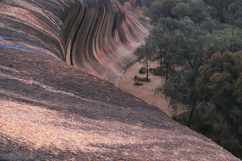
Nunber 15 : Wave Rock - Western Australia
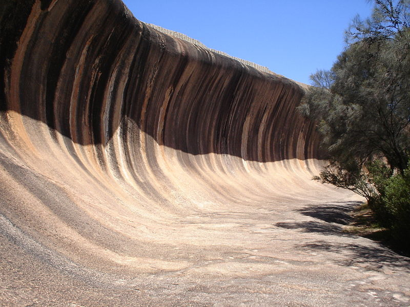
Wave rock in Western Australia
Hyden,_Western_Australia,_Wave_Rock,
View from the top
Wave Rock (Nyungar: Katter Kich) is a natural rock formation that is shaped like a tall breaking ocean wave. The "wave" is about 15 m (50 ft) high and around 110 m (360 ft) long. It forms the north side of a solitary hill, which is known as "Hyden Rock". This hill, which is a granite inselberg, lies about 3 km (2 mi) east of the small town of Hyden and 296 km (184 mi) east-southeast of Perth, Western Australia. Wave Rock and Hyden Rock are part of a 160 ha (395-acre) nature reserve, Hyden Wildlife Park. More than 100,000 tourists visit every year.
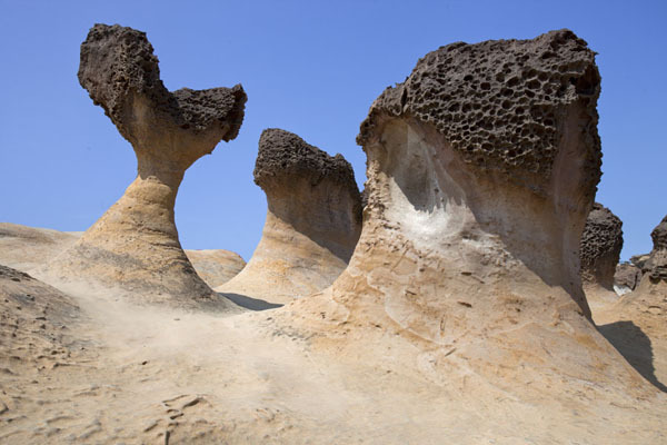
Nunber 14 : Queen's Head -Yehliu Geopark Taiwan
Yeliu geopark (野柳地質公園) 207, Taiwan, New Taipei City, Wanli District, 港東路167-1號
Queen's head, in Yei Liu, Northeastern Coast of Taiwan.
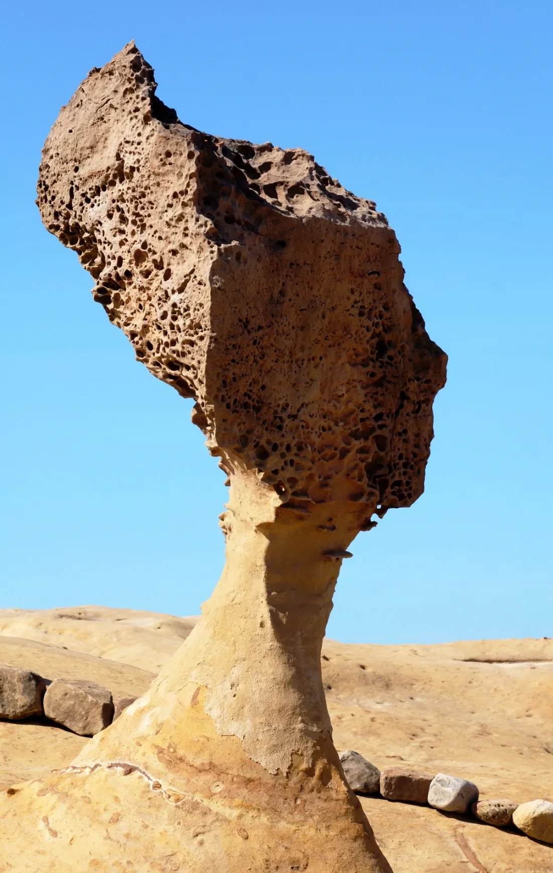
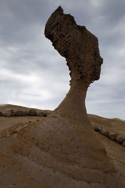
Queen's Head is the most famous narrow neck mushroom rock
The eight-metre tall Queen's Head has been subject to debates about preservation
Scientists battle to save Taiwan's 4,000-year-old Queen's Head
Some of the many mushroom rock formations at Yeliu
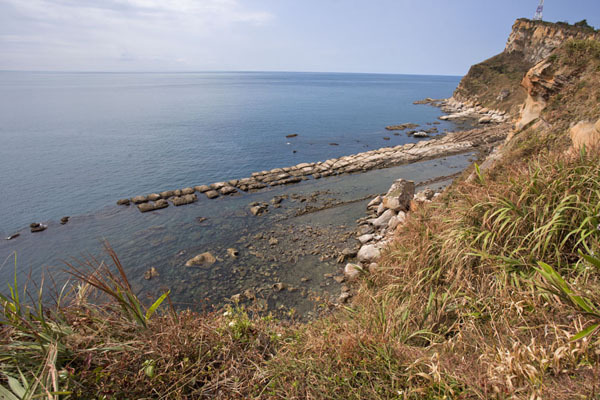
Long stretch of bean curd rock at the cape of Yeliu
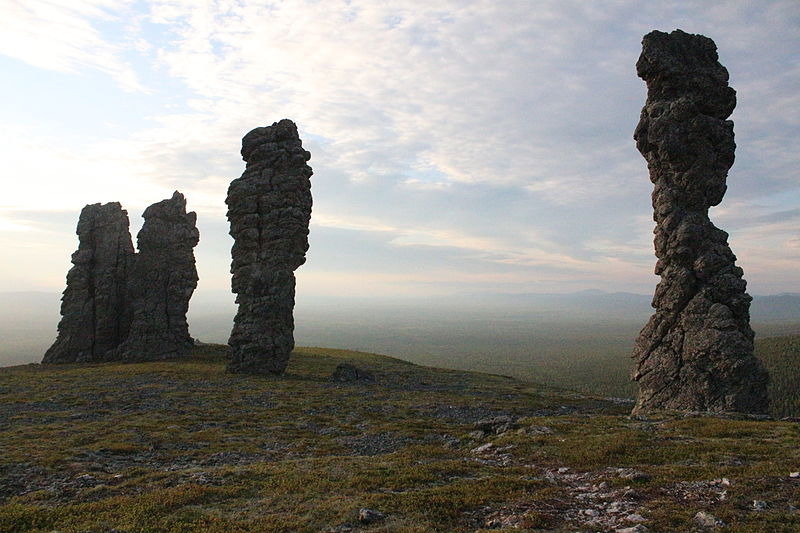
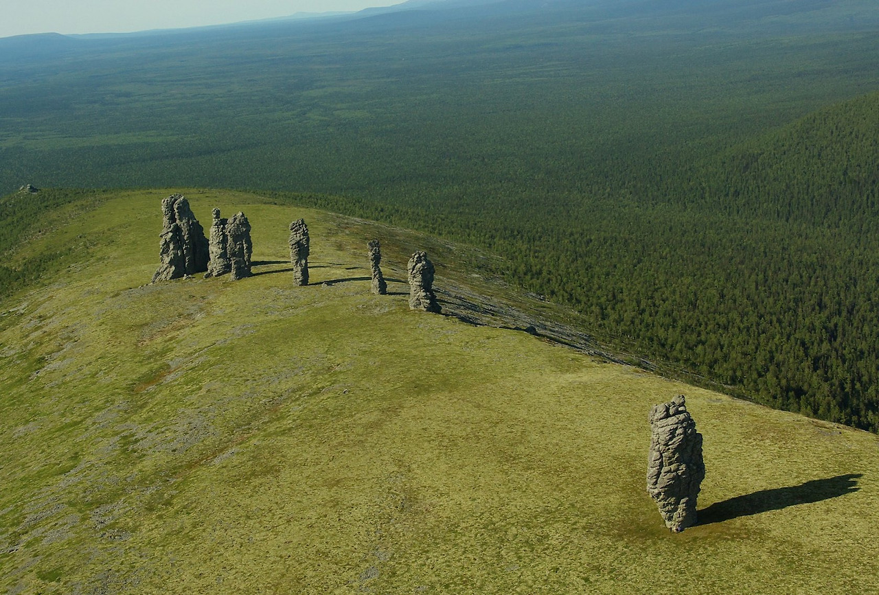
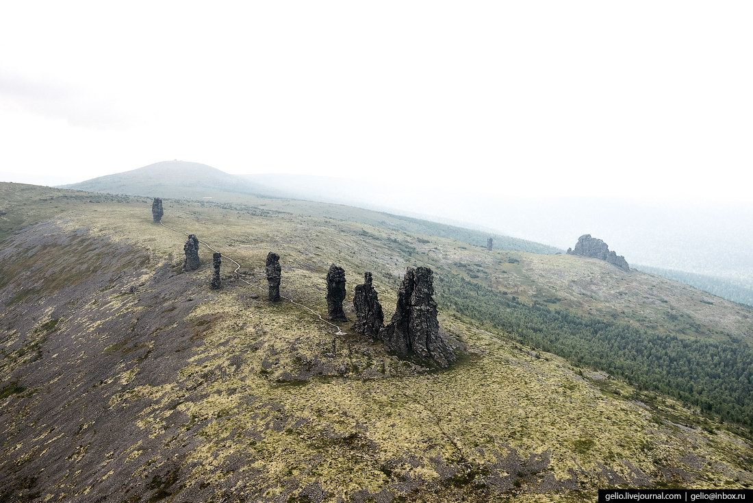
Nunber 13 : Manpupuner rock formations - Troitsko-Pechorsky District of the Komi Republic, Russia
Плато Маньпупунёр
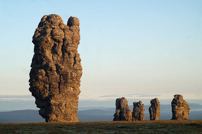
The Manpupuner rock formations
northern-urals-manpupuner-dyatlov-pass-russia
The Manpupuner rock formations (Man-Pupu-Nyor; Mansi: Мань-Пупыг-Нёр [manʲ.pupiɣ noːr], literally ’Small Idol Mountain’; Komi: Болвано-Из [bolvano iz], literally ’Idol Stone’) are a set of 7 stone pillars located west of the Ural Mountains in the Troitsko-Pechorsky District of the Komi Republic. They are located on the territory of the Pechoro-Ilychski Reserve on the mountain Man-Pupu-nyor, between the Ilych and Pechora rivers.
They are also known as the Seven Strong Men Rock Formations and the Poles of the Komi Republic. Deemed one of the Seven Wonders of Russia, the Manpupuner rock formations are a popular attraction in Russia, though relatively unspoiled by tourism.
The height of the rocks varies between 30 and 42 metres. About 200 million years ago at the location of the stone pillars, there were high mountains.
One pillar, 34 meters high, stands somewhat apart from the others. It resembles an inverted bottle. Six others lie at the edge of the cliff. The pillars are said to resemble the figures of a huge man or the head of a horse or ram.
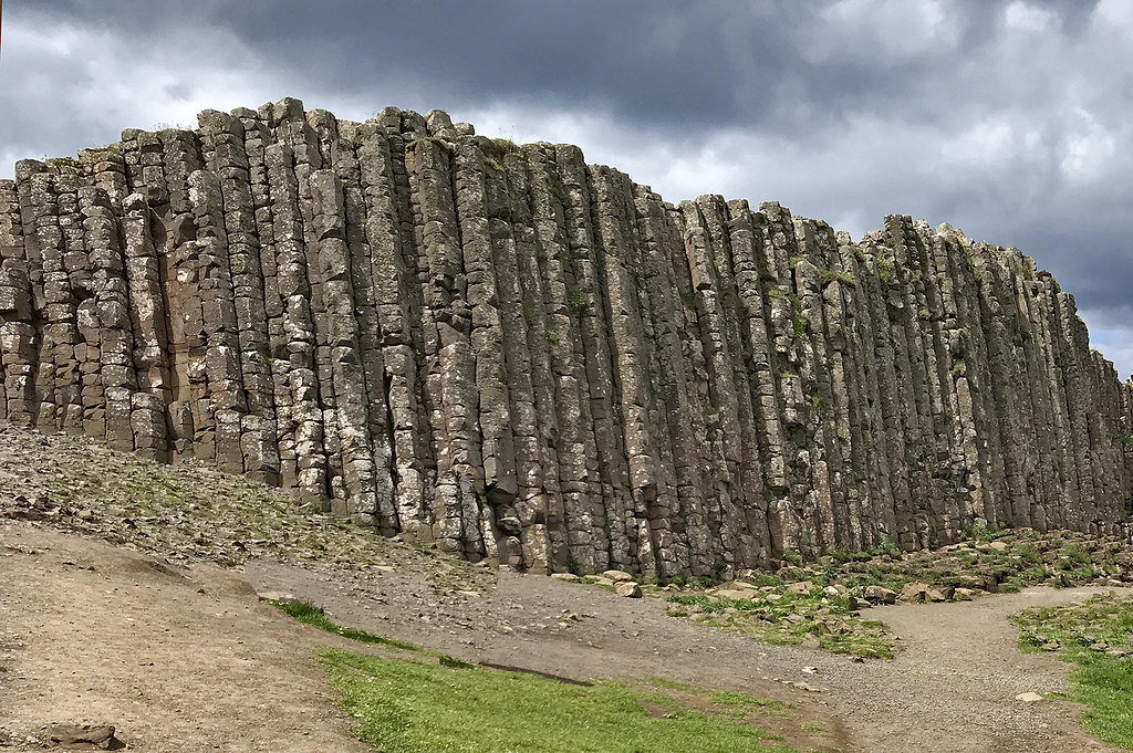
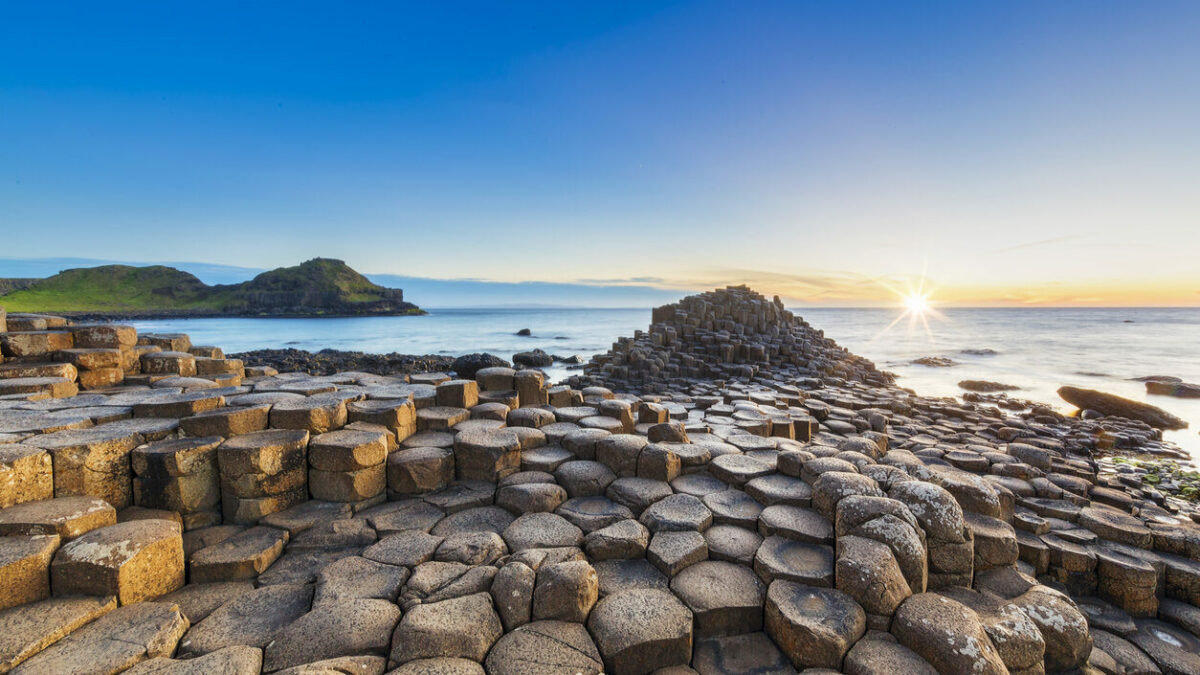
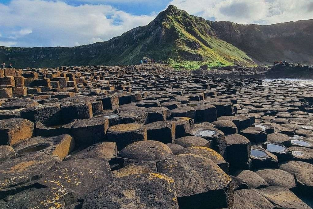
Nunber 12 : Giant's Causeway - County Antrim on the north Coast of Northern Ireland
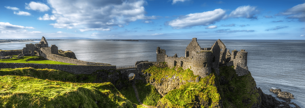
dunluce_castle_county_antrim_northern_ireland
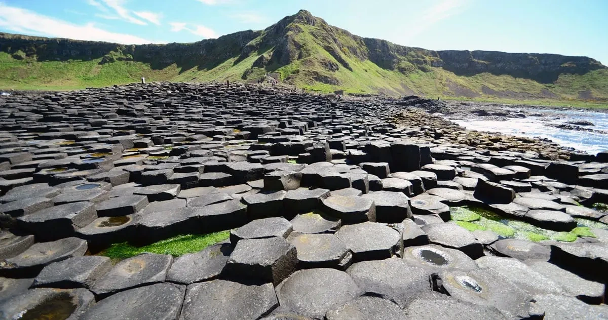
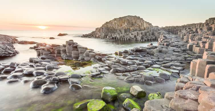
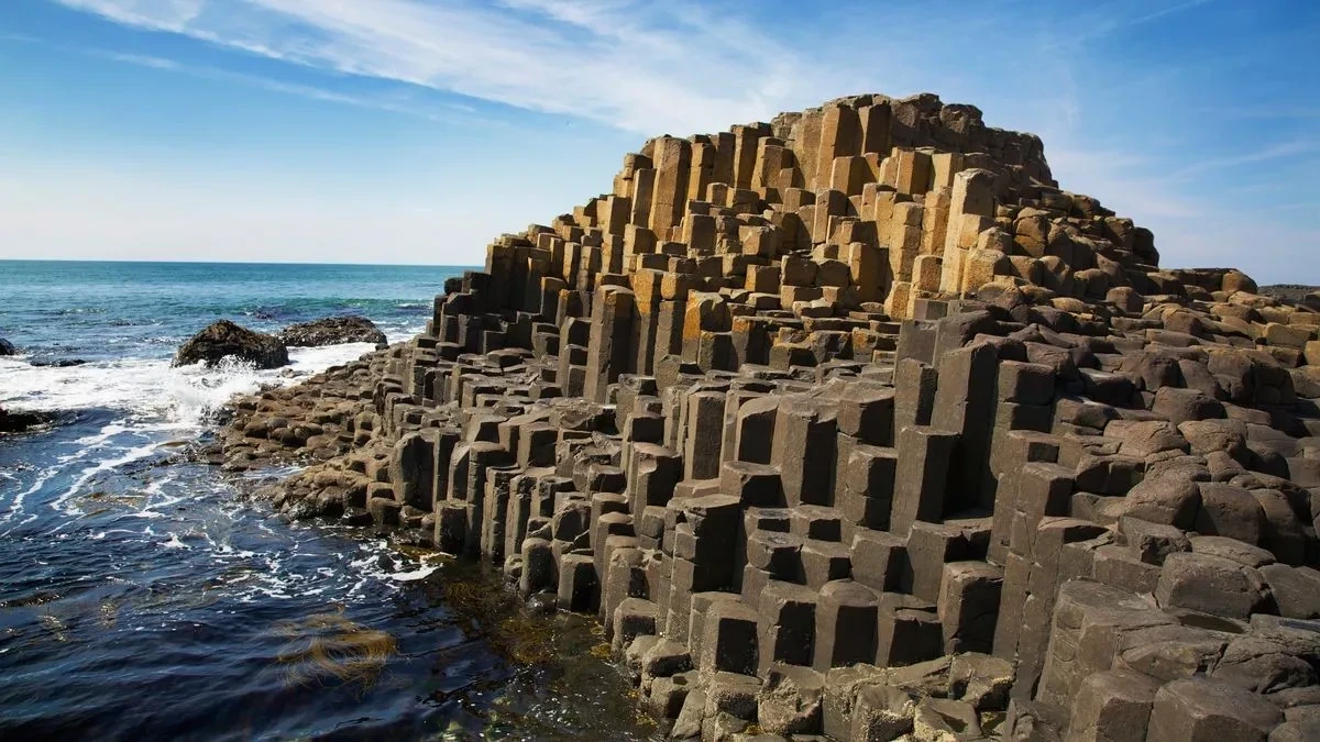
Giant's Causeway, Co. Antrim, Northern Ireland.
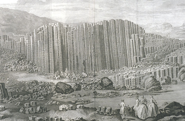
Engraving of Susanna Drury's A View of the Giant's Causeway: East Prospect, 1768
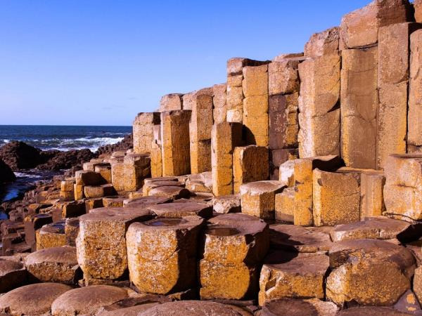
Red basaltic prisms, Giant's causeway
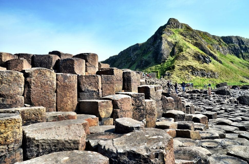
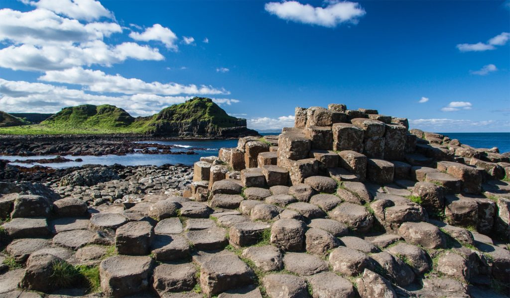
The Giant's Causeway (Irish: Clochán an Aifir) is an area of approximately 40,000 interlocking basalt columns, the result of an ancient volcanic fissure eruption. It is located in County Antrim on the north coast of Northern Ireland, about three miles (4.8 km) northeast of the town of Bushmills.
It was declared a World Heritage Site by UNESCO in 1986 and a national nature reserve by the Department of the Environment for Northern Ireland in 1987. In a 2005 poll of Radio Times readers, the Giant's Causeway was named the fourth-greatest natural wonder in the United Kingdom.
The tops of the columns form stepping stones that lead from the cliff foot and disappear under the sea. Most of the columns are hexagonal, although some have four, five, seven, or eight sides. The tallest are approximately 12 metres (39 ft) high, and the solidified lava in the cliffs is 28 metres (92 ft) thick in places.
Much of the Giant's Causeway and Causeway Coast World Heritage Site is owned and managed by the National Trust. It is one of the most popular tourist attractions in Northern Ireland, receiving more than 998,000 visitors in 2019. Access to the Giant's Causeway is free of charge: it is not necessary to go via the visitor centre that charges a fee. The remainder of the site is owned by the Crown Estate and several private landowners.
Around 50 to 60 million years ago, during the Paleocene Epoch, Antrim was subject to intense volcanic activity, when highly fluid molten basalt intruded through chalk beds to form an extensive volcanic plateau.
Nunber 11 : Árbol de Piedra("stone tree") - Siloli Desert of Southwestern Bolivia
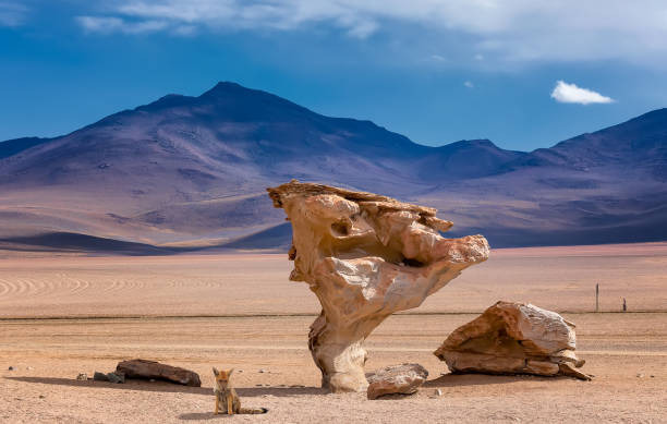
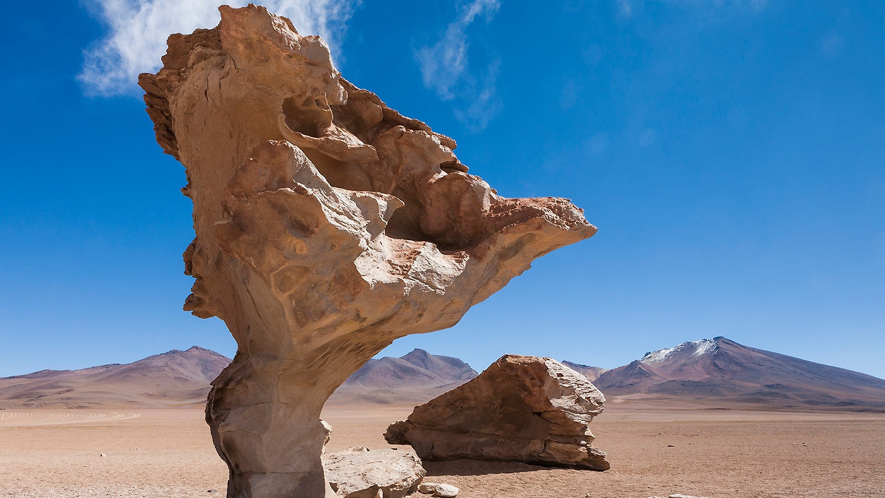
Tree rock Árbol de Piedra in Siloli Desert, Atacama, Bolivia
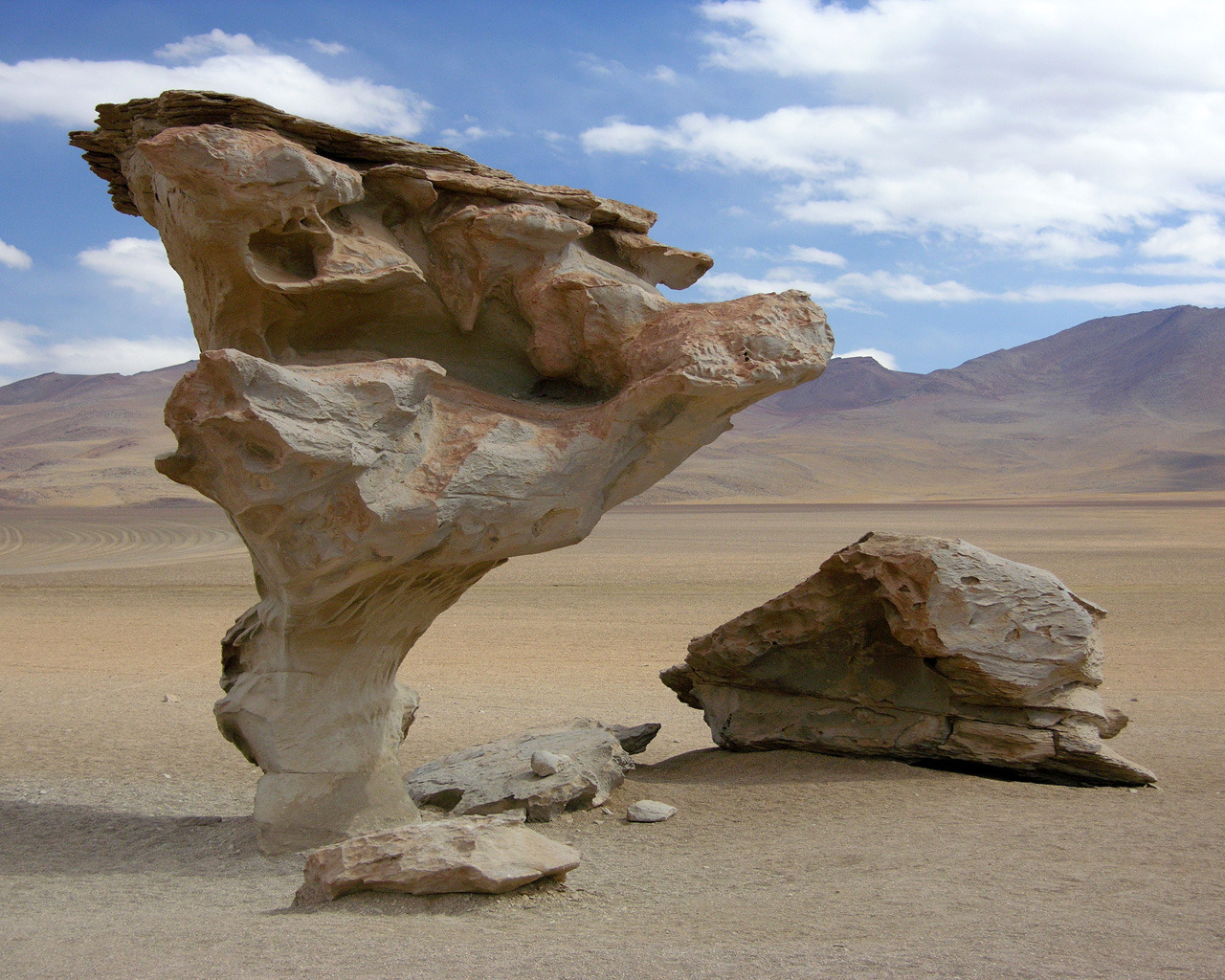
Árbol de Piedra ("stone tree") is an isolated rock formation in the Eduardo Avaroa Andean Fauna National Reserve of Sur Lípez Province, Bolivia.
Much photographed, it projects out of the altiplano sand dunes of Siloli in the Potosí Department, about 18 kilometres (11 mi) north of Laguna Colorada. Known as the "Stone Tree," it is shaped like a stunted tree about 7 m high. Its shape, particularly the thin stem, are due to strong winds carrying sand and eroding the soft sandstone.
Nunber 10 : Bryce Canyon National Park - Southwestern Utah

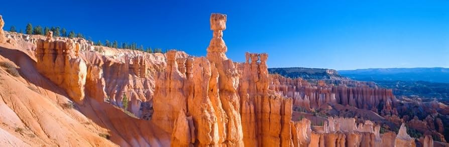
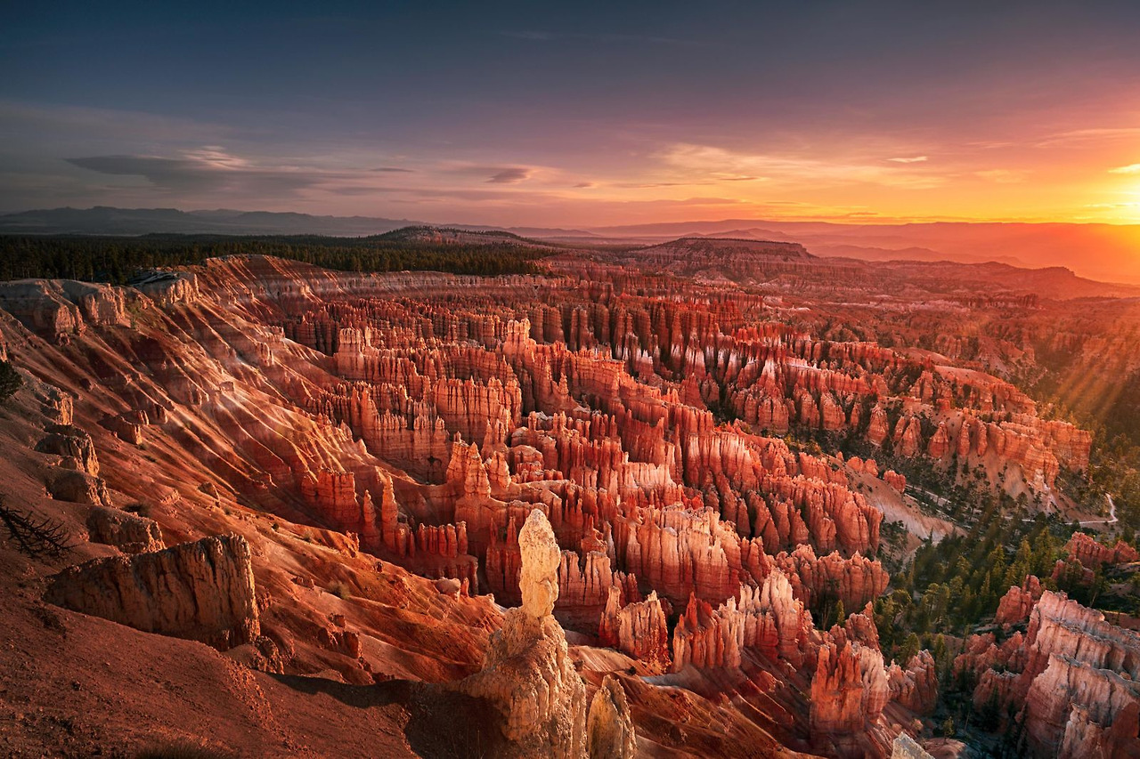

Bryce Canyon National Park (/braɪs/) is a national park of the United States located in southwestern Utah. The major feature of the park is Bryce Canyon, which despite its name, is not a canyon, but a collection of giant natural amphitheaters along the eastern side of the Paunsaugunt Plateau. Bryce is distinctive due to geological structures called hoodoos, formed by frost weathering and stream erosion of the river and lake bed sedimentary rock. The red, orange, and white colors of the rocks provide spectacular views for park visitors. Bryce Canyon National Park is much smaller and sits at a much higher elevation than nearby Zion National Park. The rim at Bryce varies from 8,000 to 9,000 feet (2,400 to 2,700 m).
The area is in portions of Garfield County and Kane County.
The Bryce Canyon area was settled by Mormon pioneers in the 1850s and was named after Ebenezer Bryce, who homesteaded in the area in 1874. The area was originally designated as a national monument by President Warren G. Harding in 1923 and was redesignated as a national park by Congress in 1928.
The park covers 35,835 acres (55.992 sq mi; 14,502 ha; 145.02 km2) and receives substantially fewer visitors than Zion National Park (nearly 4.3 million in 2016) or Grand Canyon National Park (almost 6 million in 2016), largely due to Bryce's more remote location. In 2023, Bryce Canyon received 2,461,269.
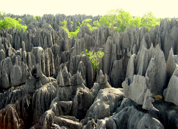
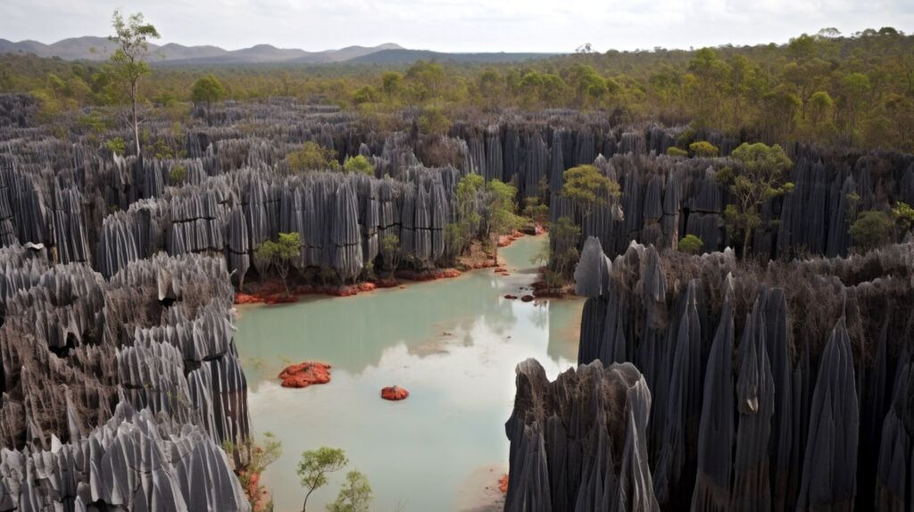
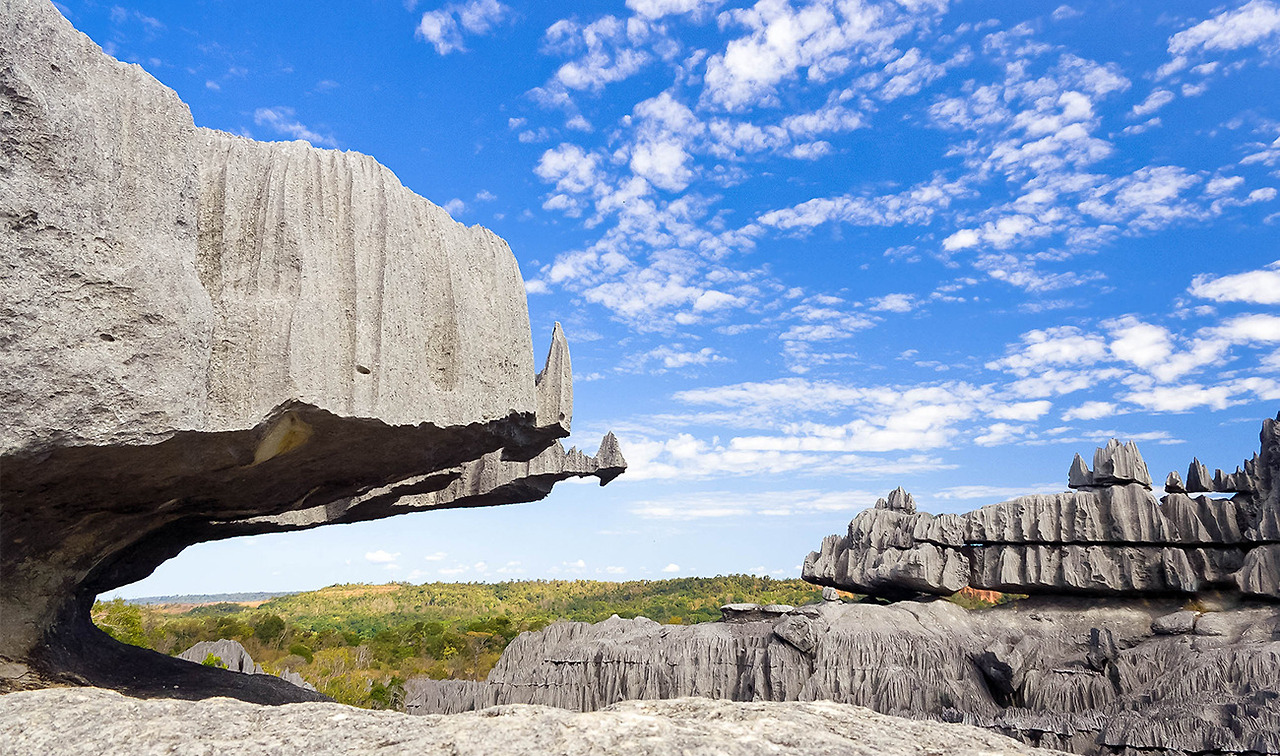
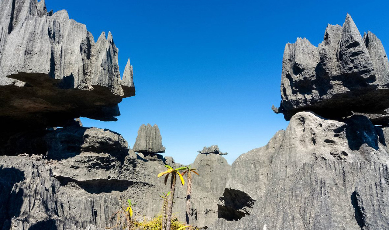
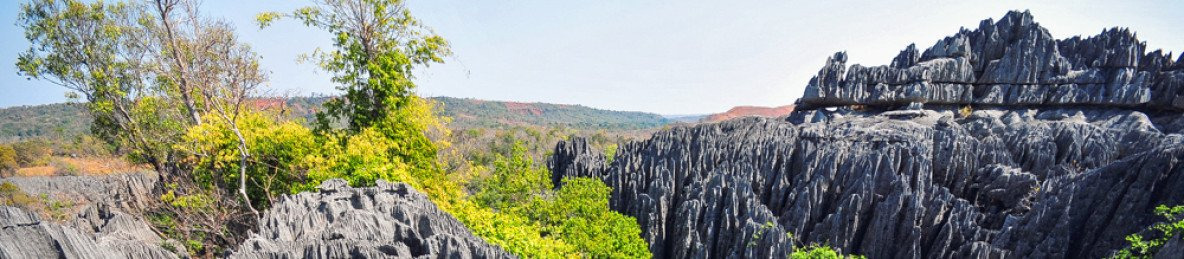
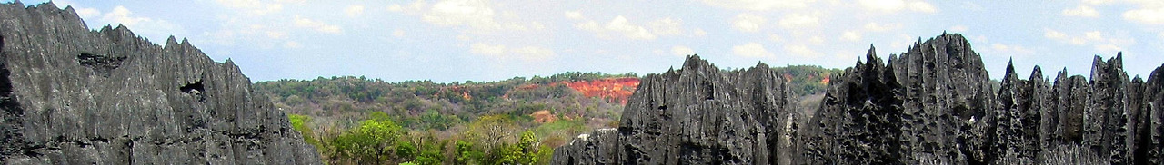
Nunber 9 : Tsingy de Bemaraha National Park - Madagascar
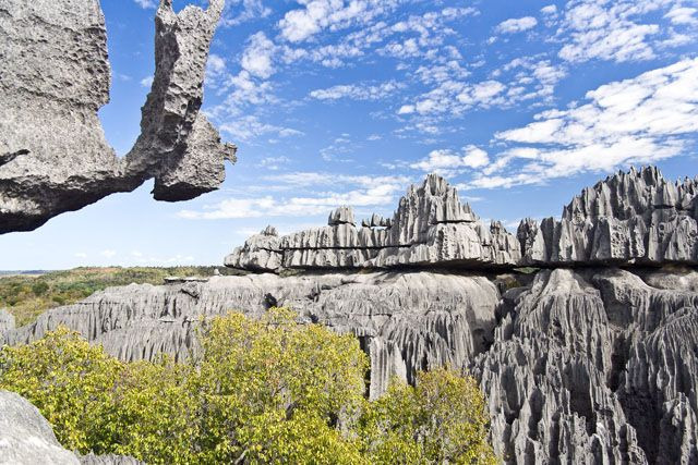
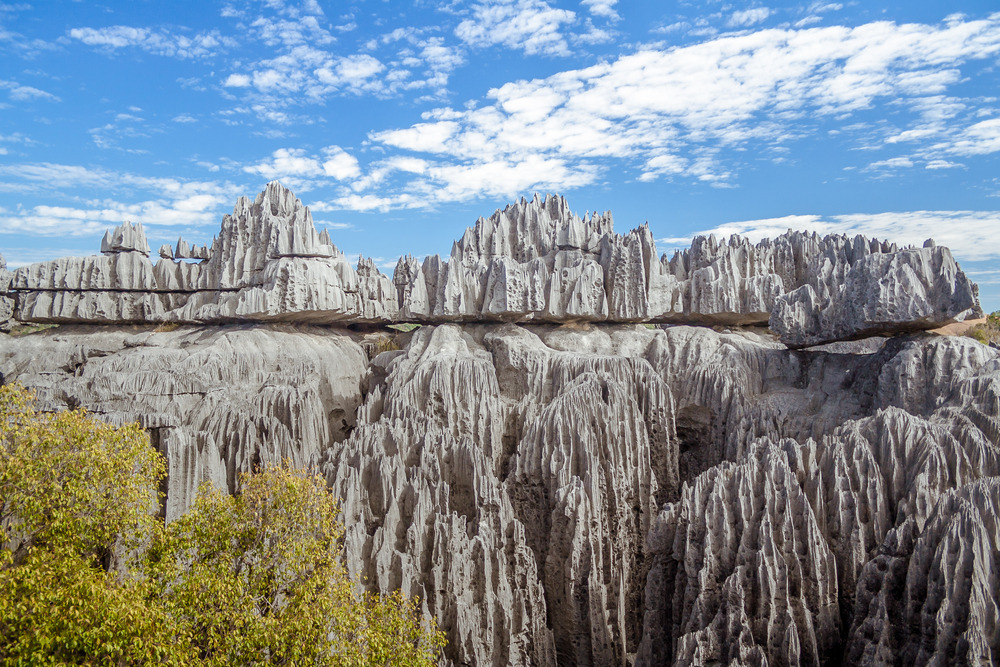
The Tsingy de Bemaraha National Park is a national park located in northwest Madagascar. It is mainly within the boundaries of Antsalova District, with a small part in the northeast falling within Morafenobe District.
The national park centers on two geological formations: the Great Tsingy and the Little Tsingy. Together with the adjacent Tsingy de Bemaraha Strict Nature Reserve, the National Park is a UNESCO World Heritage Site.
It is crossed by the Manambolo River.
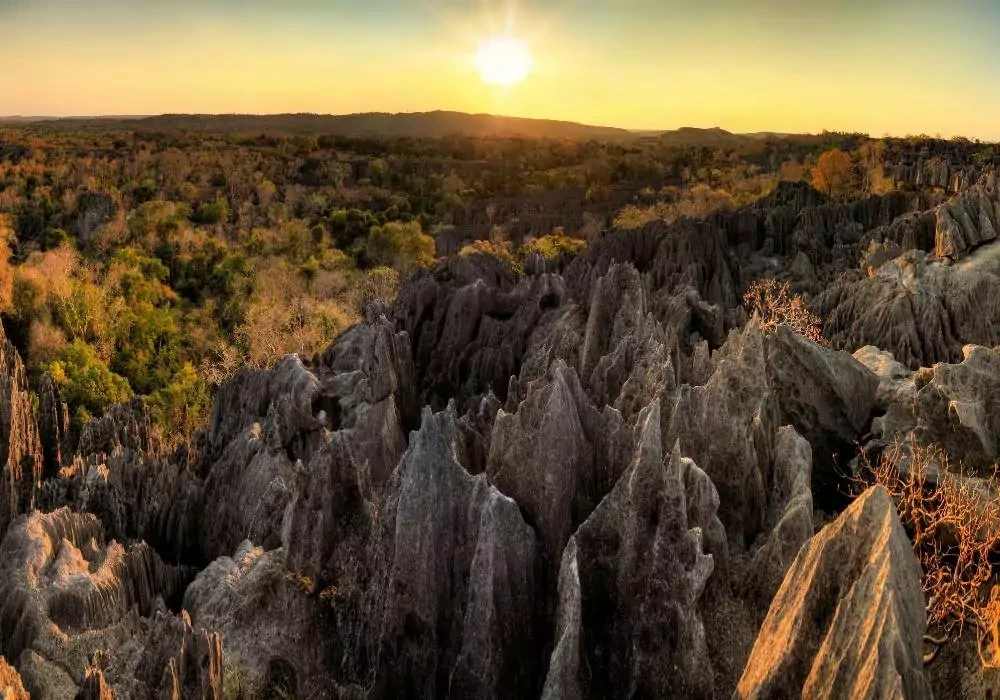
Tsingy de Bemaraha is one of Madagascar’s newest parks – it was opened to the public only in 1998. The 152,000 ha (587 sq mi) Bemaraha is best known for its tsingy sharp limestone pinnacles that may reach 150 feet (45 m) in height. Cut through the tsingy are canyons and gorges full of rich fauna and flora.
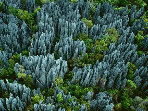
The Tsingys are karstic plateaus in which groundwater has undercut the elevated uplands, and has gouged caverns and fissures into the limestone. The word tsingy is indigenous to the Malagasy language as a description of the karst badlands of Madagascar. The word can be translated into English as where one cannot walk barefoot. This place is a UNESCO World Heritage Site since 1990.


'Wonderful World' 카테고리의 다른 글
| 'United by history, heritage', Biden tells Mayo crowd in closing speech (0) | 2024.10.14 |
|---|---|
| MOST Unbelievable Rock Formations From Earth's Past 2 (1) | 2024.10.14 |
| The most incredible rock pillar landscapes. (0) | 2024.10.14 |
| Archaeologists discover 3,000-year-old structure mentioned in the Bible (1) | 2024.10.14 |
| [박정은의 길에서만난 사람] 중국- 쓰촨성 (四川省) 청두(成都) (7) | 2024.10.14 |