2025. 1. 29. 11:52ㆍWonderful World
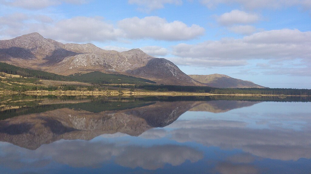
Twelve Bens summits of Bencorr and Benncorr North Top, and also showing Bencorr's two easterly spurs, from Lough Inagh. Mountain in the far background is Benbaun. Lough Inagh, Connemara, Co. Galway, Ireland
Derryclare Horseshoe, Connemara, Ireland
Derryclare with the rest of the Glencoaghan Horseshoe in cloud

Lough Inagh from slopes of Letterbreckaun, with Derryclare (l), Bencorr (c), and Benbaun (r)
Lough Inagh (Irish: Loch Eidhneach, meaning 'lake of the place of ivy') is a freshwater lake in the Inagh Valley, in Connemara, County Galway, in the west of Ireland.

Derryclare (l), Bencorr (c), Bencorr North Top (r), and two Log an Choire corries
Geography
Lough Inagh is located about 23 km (14 mi) east of Clifden on the R344 road in the Inagh Valley. The Twelve Bens range lies to the west of the lake, with Derryclare 677 metres (2,221 ft) and Bencorr 711 metres (2,333 ft) directly overlooking the lake. The bulk of the Maumturks range and its long central spine lies to the east of the lake, with two highest peaks of Letterbreckaun 677 metres (2,221 ft) and Binn idir an Dá Log 702 metres (2,303 ft), also overlooking the Lough.

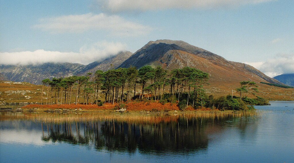
Lough Inagh and the Twelve Bens, viewed from the Maumturks
Lough Inagh is fed from several mountain streams in the area, but most importantly from the Gleninagh River that starts high up in the Gleninagh Valley on the slopes of Benbaun and Bencollaghduff, and the Tooreennacoona River. After flowing into Lough Inagh, the river flows into Derryclare Lough, and then into Ballynahinch Lake, where it eventually joins the Owenmore River where is flows into Bertraghboy Bay.

Lough_Inagh,_Connemara,_Ireland
Lough Inagh and Lissoughter (back, right), viewed from Knockpasheemore

Twelve_Bens_from_Lough_Inagh
Looking west over Lough Inagh to Derryclare and Bencorr–Bencorr North Top, and the two Log an Choire corries


Bencorr (The Twelve Bens)


Bencorr and Lough Inagh in Connemara, County Galway, Ireland

Bencorr and Lough Inagh in Connemara, County Galway, Ireland
More than half the communities collectively called the Gaeltacht—pockets of Ireland where Irish is spoken daily—are found here in County Galway. This region, Connemara, is especially noted for preserving its Irish language and culture, not to mention natural beauty (seen here in abundance as sunrise-bathed Bencorr reflects upon Lough Inagh). Though the Gaeltacht is sadly shrinking, the resilient Irish tongue isn't out of luck yet: Census data suggest most teens throughout the Emerald Isle are proficient speakers.

View over Lough Inagh in Connemara, Ireland

Derryclare Lough - Connemara Lake

Glencoaghan Horseshoe loop (12 Bens)
Derryclare Lough is a lake at the entrance of the Inagh Valley, in Connemara, Galway.

Connemara

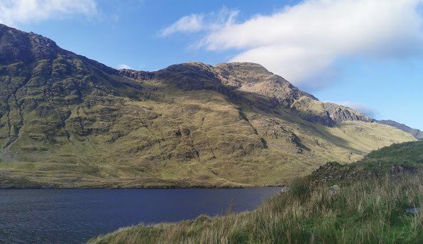
The view northwest along the Maumturk ridge from Binn idir an dá Log.

View toward Bencorr, Bencollaghduff, Benbaun and the Maumina col
from Derryclare Mountain.

View into the Glencoaghan Horseshoe from Derryclare Lough
Derryclare Lough (Irish: Loch Dhoire an Chláir ) is a freshwater lake at the entrance of the Inagh Valley, in Connemara, County Galway, in the west of Ireland.

Derryclare (centre), Bencorr (left), and Bencollaghduff (far left)
Derryclare Lough, Twelve Bens, Connemara, Ireland.
The mountain behind is Derryclare

Errisbeg and Roundstone Bog, Connemara, County Galway, Connacht,
Republic of Ireland, Europe


Stacks of turf, in process called footing, drying on peat bog, by Lough Inagh near Recess
in Connemara, County Galway, Ireland

Kylemore Abbey, Connemara, County Galway, Connacht,
Republic of Ireland, Europe

Roundstone Bog and 12 Bens, Connemara, County Galway, Connacht,
Republic of Ireland, Europe
'Wonderful World' 카테고리의 다른 글
| Cathedral Cove walking track reopens after almost two years of repairs (0) | 2025.01.30 |
|---|---|
| Los Glaciares National Park,in Santa Cruz Province, Argentina. (0) | 2025.01.29 |
| The northern saw-whet owl (Aegolius acadicus) (0) | 2025.01.29 |
| Kaimanawa Mountains & Kaimanawa wall in NZ (0) | 2024.12.30 |
| Guilin桂林市, China (0) | 2024.12.29 |