2025. 2. 15. 08:04ㆍWonderful World
Flores Island
Island in Portugal

Corvo Island, Azores

Corvo Island tour from Flores, Azores


Bruno-Azera-Flores-Azores

Azores Maderia


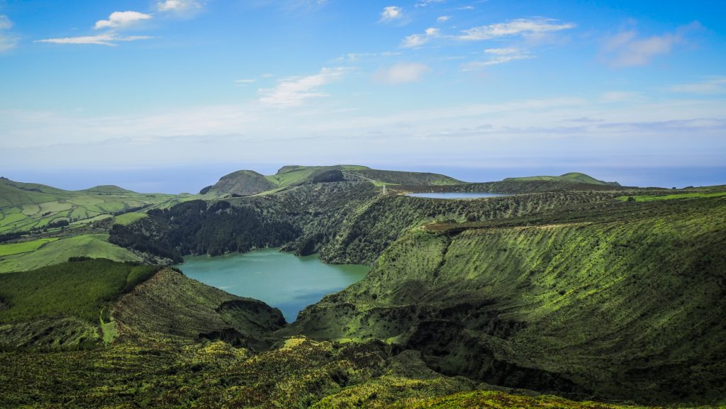
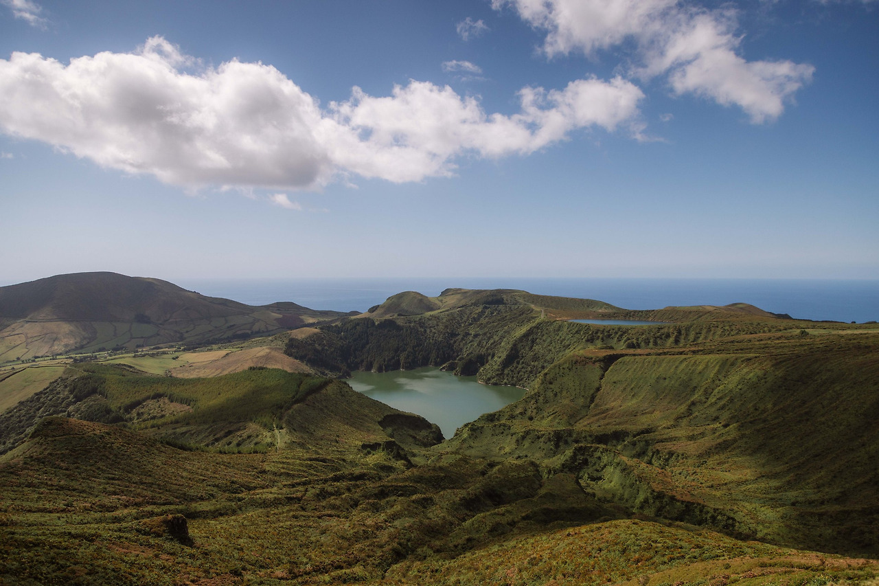
azores-sao-miguel-island-lake-fogo


flores-hydrangeas-wild


Cascata do Poço do Bacalhau

Rocha dos Bordões

Fajã de Lopo Vaz


Poço da Ribeira do Ferreiro

Cascata da Ribeira do Ferreiro


Baía de Alagoa Flores Azores


Pozo-da-Alagoinha-flores


Flores Island
Native name: Ilha das Flores
Nickname: The Yellow Island

The Flores island collection XX
View of the island's southern side, with the Funda Lake downhill

Map-of-the-mainland-Portugal-and-Azores-Islands
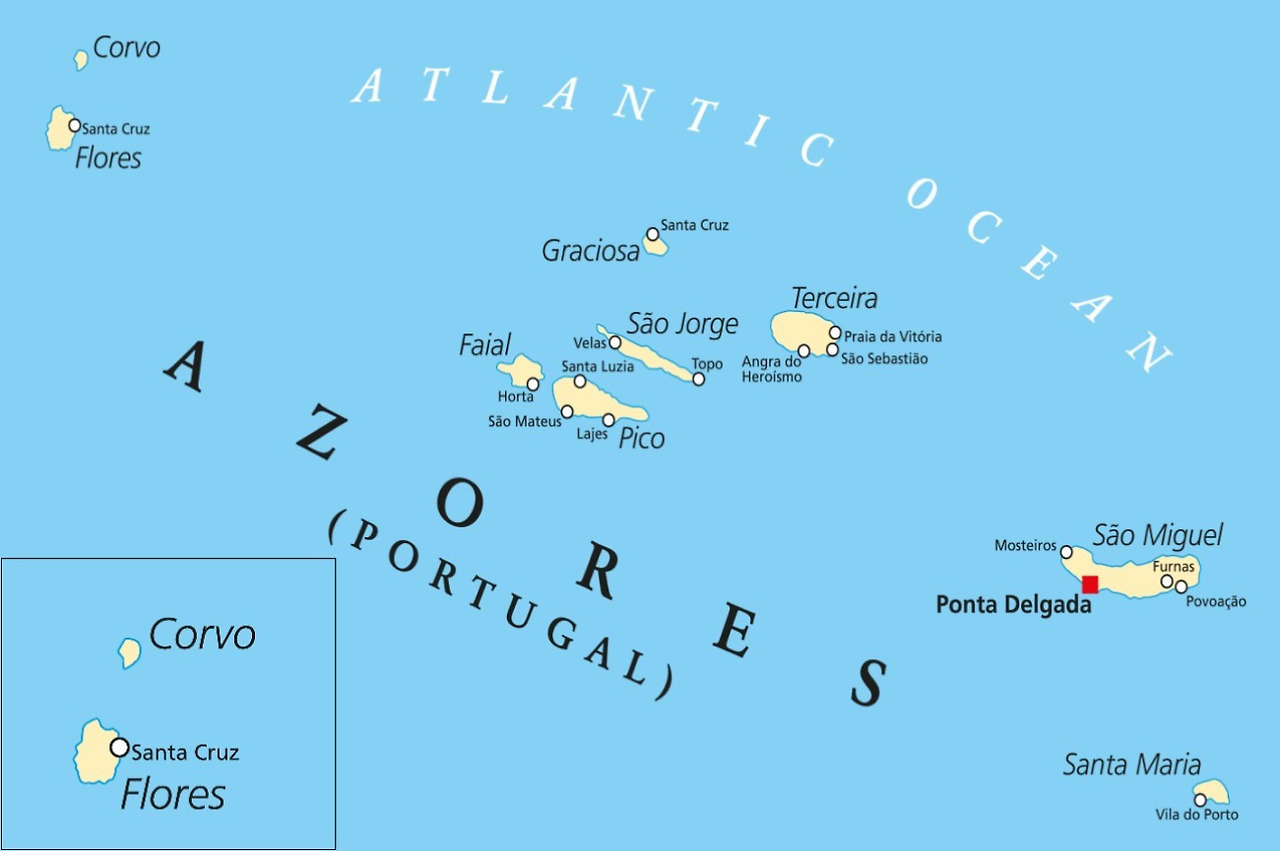

Map of Flores
Flores Island (Portuguese: Ilha das Flores; Portuguese pronunciation: [ˈfloɾɨʃ]) is an island of the Western Group (Grupo Ocidental) of the Azores.
It has an area of 143 km2, a population of 3428 inhabitants, and, together with Corvo Island of the western archipelago, lies within the North American Plate. The nearby Monchique Islet is the westernmost point of Portugal.
It has been referred to as the Ilha Amarelo Torrado ('Yellow/Auburn Island') and due to the association with poet Raul Brandão. It is well known for its abundance of flowers, hence its Portuguese name of Flores.

FLORES AIRPORT

Fajãzinha, in the municipality of Lajes das Flores, is a typical Azorean village that includes ruins of watermills. Nearby are several waterfalls which flow into the Ribeira Grande.
On May 27, 2009, Flores was chosen as one of the several areas on the UNESCO list of World Network of Biosphere Reserves at the Man and the Biosphere Programme meeting.
Poco da Ribeira do Ferreiro, Flores Island, Azores


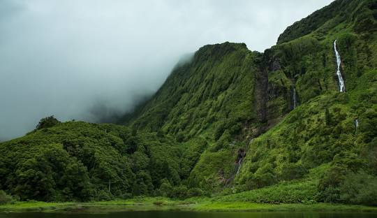
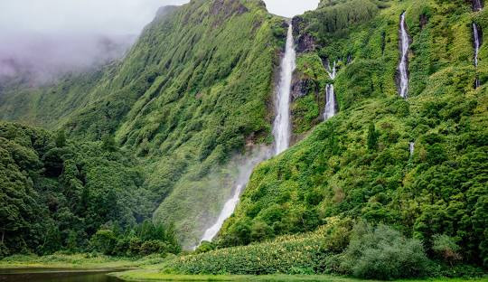

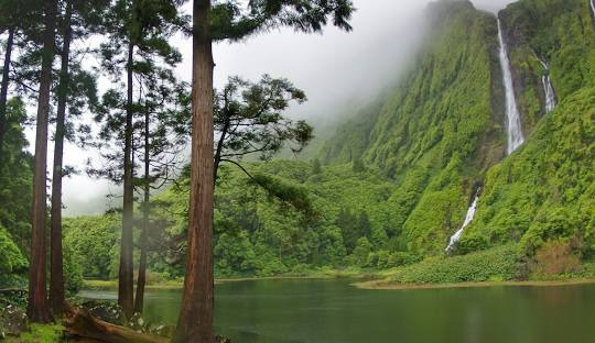
Poco da Ribeira do Ferreiro, Flores Island, Azores

Poco da Ribeira do Ferreiro, Flores Island, Azores
Some describe this part of Flores Island as unspoiled perfection; others call it a 'lost Eden.' Here at Ribeira do Ferreiro, dozens of waterfalls tumble down soaring, steep basalt cliffs carpeted in lush greenery, with some falls flowing into a wide pond. One reason this landscape remains pristine is due to its remote location. The Azores island chain is an autonomous region of Portugal, set some 850 miles west of the Portuguese mainland in the Atlantic Ocean. Another reason for the Edenic vibe? In 2007, UNESCO declared the entire island of Flores a Biosphere Reserve. The designation helps to balance commercial interests with ecological concerns and aims for sustainable development.

Poco da Ribeira do Ferreiro, Flores Island, Azores
Ponta_Delgada_Flores_Azores_North
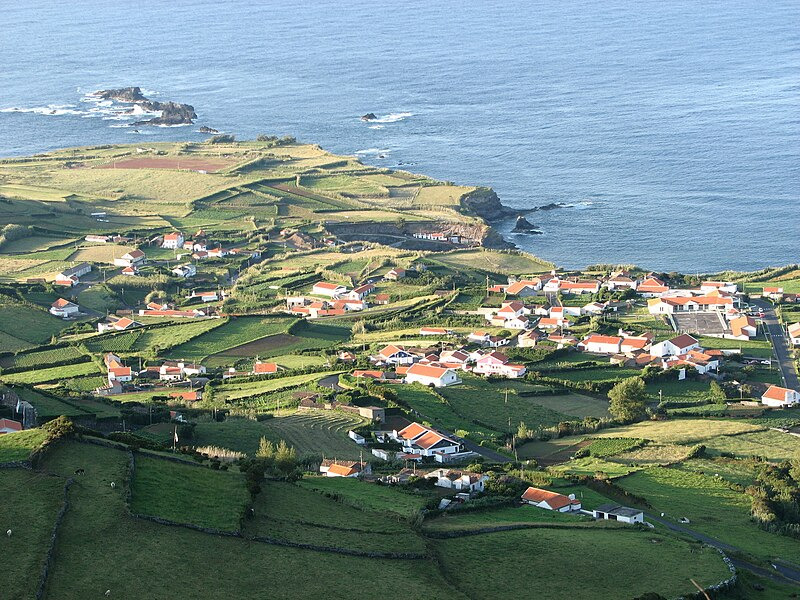
Ponta Delgada, settled in 1571, by Diogo das Chagas, immediately becoming a parish, located in Santa Cruz das Flores

Fajãzinha,
located along an alluvial plain fed by five lakes and ravines on the upper plateau of Lajes das Flores
The island's isolation has been remedied during the 20th century, first with the installation of telegraph services, then the establishment of Radio-Flores (1909), and later with point-to-point telephone communication (1925). Service between the island and the rest of the archipelago was handled by small sailing ships until the beginning of the century, with ships such as the 36-ton yacht Santa Cruz or 80-ton yacht Flores, until the latter was lost in the bay of Porto Pim, Horta, Faial during a storm.
In July 1962, the French laid the foundations for a missile tracking installation on the island, which was inaugurated in October 1966. In the following years, a hospital, a power station, and an airport were established, which brought a financial upswing to the entire island. After the French left the island in 1994, tourism became the island's dominant industry.
'Wonderful World' 카테고리의 다른 글
| Red ash hills & Rauðaskál in Iceland (0) | 2025.02.15 |
|---|---|
| Urquhart Castle, Scotland (0) | 2025.02.15 |
| Budapest- with Danube-river, Hungary (0) | 2025.02.15 |
| Tre Cime di Lavaredo, Italy (0) | 2025.02.15 |
| Fraser River at Rearguard Falls, British Columbia, Canada (0) | 2025.02.12 |