2025. 3. 16. 06:34ㆍWonderful World
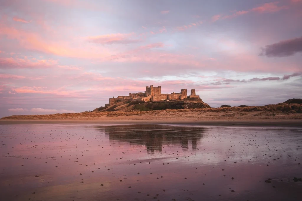

Bamburgh Castle
Northumberland
Ceremonial county

Morpeth Clock Tower, Northumberland
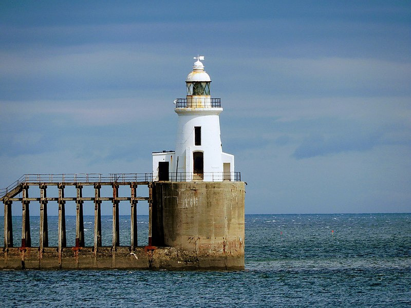
UK - Blyth East Pier Lighthouse
Built in 1907 to aid ships entering the River Blyth and Blyth Harbour.
Northumberland (/nɔːrˈθʌmbərlənd/ nor-THUM-bər-lənd) is a ceremonial county in North East England, on the border with Scotland. It is bordered by the North Sea to the east, Tyne and Wear and County Durham to the south, Cumbria to the west, and the Scottish Borders council area to the north. The town of Blyth is the largest settlement. Northumberland is the northernmost county in England.
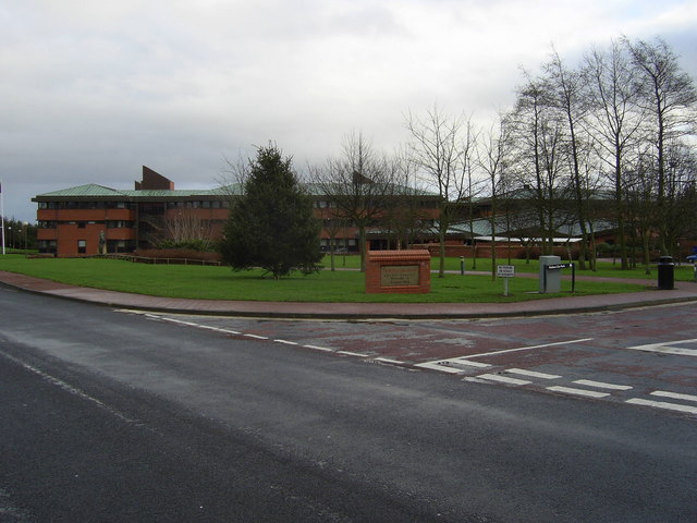
The county has an area of 5,013 km2 (1,936 sq mi) and a population of 320,274, making it the least-densely populated county in England. The south-east contains the largest towns: Blyth (37,339), Cramlington (27,683), Ashington (27,670), and Morpeth (14,304), which is the administrative centre.
The remainder of the county is rural, and the largest towns are Berwick-upon-Tweed (12,043) in the far north and Hexham (13,097) in the west. For local government purposes the county is a unitary authority area. The county historically included the parts of Tyne and Wear north of the River Tyne.
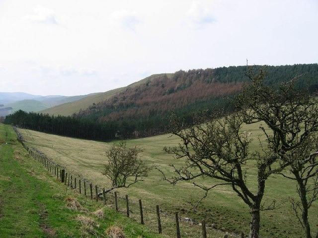
The west of Northumberland contains part of the Cheviot Hills and North Pennines, while to the east the land becomes flatter before reaching the coast. The Cheviot (815 m (2,674 ft)), after which the range of hills is named, is the county's highest point. The county contains the source of the River North Tyne and much of the South Tyne; near Hexham they combine to form the Tyne, which exits into Tyne and Wear shortly downstream.
The other major rivers in Northumberland are, from south to north, the Blyth, Coquet, Aln, Wansbeck and Tweed, the last of which forms part of the Scottish border. The county contains Northumberland National Park and two national landscapes: the Northumberland Coast and part of the North Pennines.
Much of the county's history has been defined by its position on a border. In the Roman era most of the county lay north of Hadrian's Wall, and the region was contested between England and Scotland into the Early Modern era, leading to the construction of many castles, peel towers and bastle houses, and the early modern fortifications at Berwick-upon-Tweed.
Northumberland is also associated with Celtic Christianity, particularly the tidal island of Lindisfarne. During the Industrial Revolution the area had significant coal mining, shipbuilding, and armaments industries.
Name origin
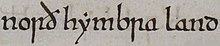
An early mention of Northumberland as norð hẏmbra land "north of Humber land" in the Anglo-Saxon Chronicle
The name of Northumberland is recorded in the Anglo-Saxon Chronicle as norð hẏmbra land, meaning "the land north of the Humber". The name of the kingdom of Northumbria derives from the Old English Norþan-hymbre meaning "the people or province north of the Humber", as opposed to Southumbria, south of the Humber Estuary.

Long Crag summit
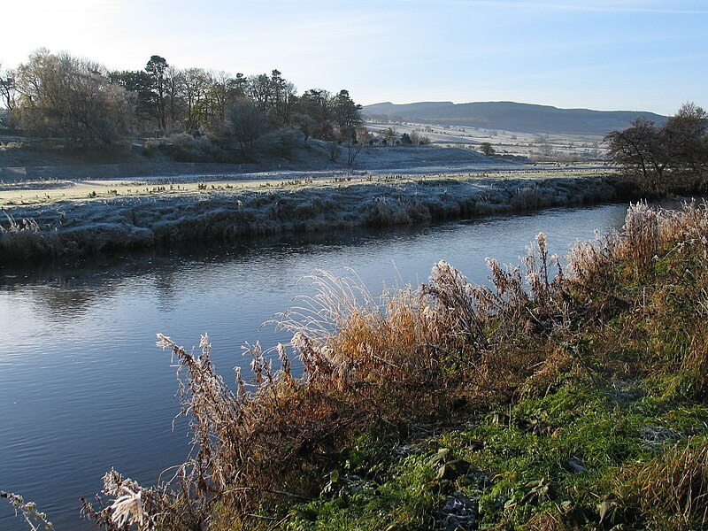
River Coquet at Rothbury, Northumberland

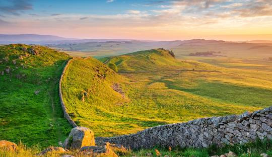
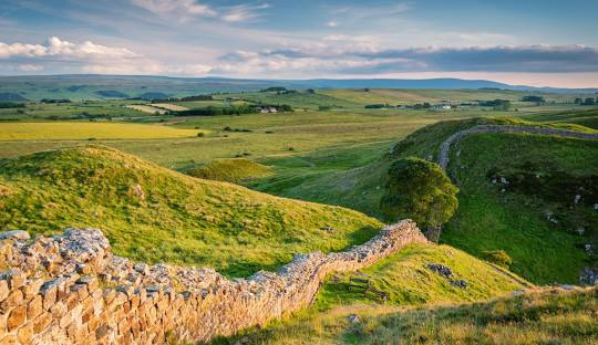
Hadrian's Wall and Milecastle 42 (Northumberland, England, UK)
Northumberland

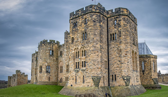
Alnwick Castle

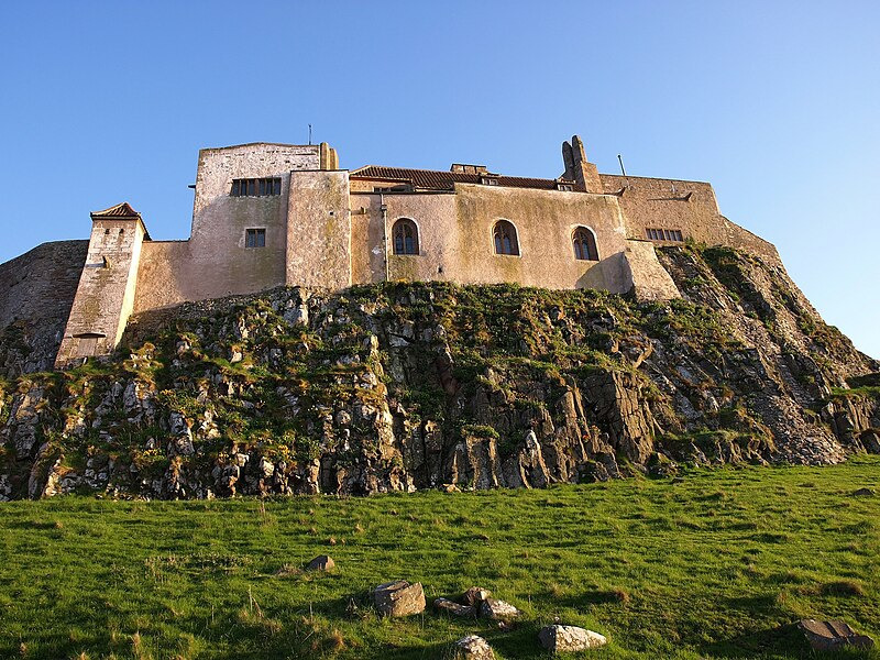
Bamburgh Castle

Holy Island


Dunstanburgh Castle

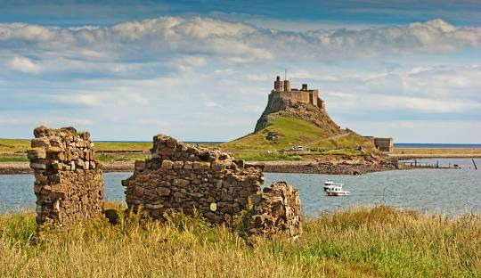
Lindisfarne Castle

노섬벌랜드 주(Northumberland)는 잉글랜드의 주로 주도는 모페스이며 면적은 5,013km², 인구는 316,300명(2014년 기준)이다. 서쪽으로는 컴브리아 주, 남쪽으로는 더럼 주와 타인 위어 주, 동쪽으로는 북해, 북쪽으로는 스코틀랜드와 접한다. 동쪽으로는 북해와 접하며 그 해안선은 총 103km에 달한다.
노섬벌랜드는 잉글랜드-스코틀랜드 경계에 놓여 있기 때문에 역사상 수많은 전투의 배경이 되기도 하였다. 이 때문에 성과 요새들이 많다. 또 아직 개발되지 않은 고지대 황야를 간직한 고장으로도 유명하며, 지금은 노섬벌랜드 국립공원으로 보존되어 있다. 인구 밀도는 1km²당 63명에 불과해 잉글랜드에서 가장 낮다.
노섬벌랜드라는 말은 원래 '험버 강 북쪽 사람들의 고장'이란 뜻이었다. 지금의 지역은 옛 고장의 핵심부에 해당되며 이전에는 잉글랜드와 스코틀랜드 간의 국경 지대였다.

Northumberland-Hills
뱀버러 성은 7세기 노섬브리아 왕국의 수도로 시작되었으며, 11세기 노르만 양식의 성채로 지어졌습니다. 이 성은 15세기에 방어 요새로 사용되었으며, 장미 전쟁 동안 워릭 백작에게 공격을 당해 함락되었습니다. 뱀버러 성은 영국의 중요한 고고학적 현장 중 하나입니다.

Flag of Northumberland flown in Hexham
County Hall, Morpeth
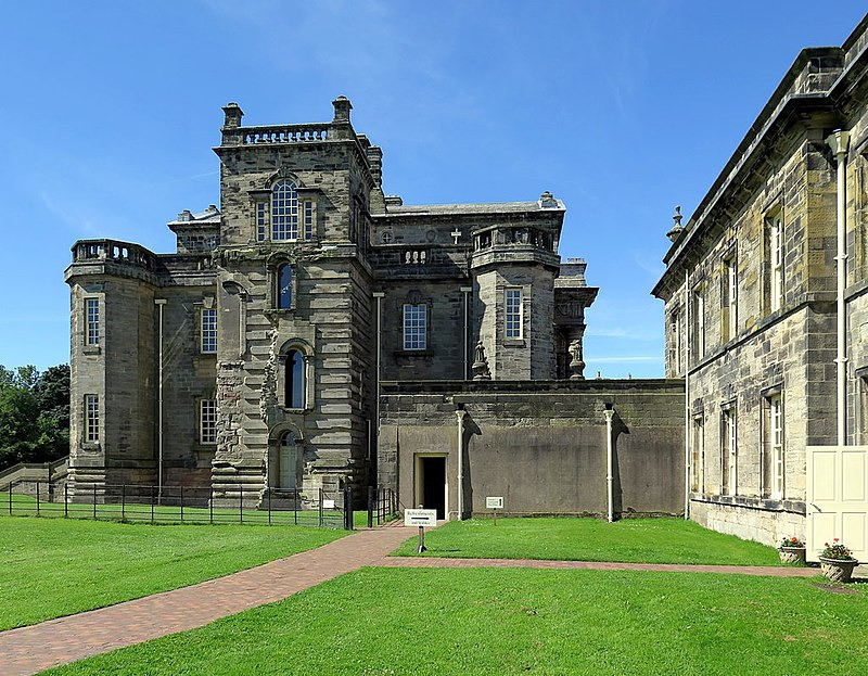
Seaton Delaval Hall
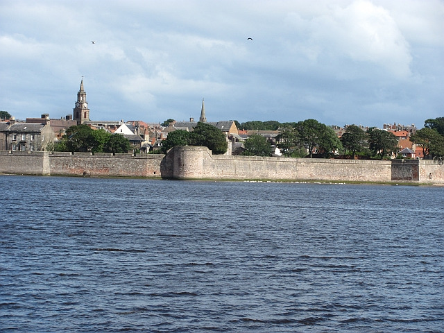
Berwick town walls
Lindisfarne Castle , Holy Island

Northumberlandia
Looking down her nose, Northumberlandia
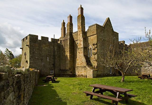
Aydon Castle

Cilurnum commander's house
Ruins of Commander's House (Praetorium) with details of the central floor heating system (hypocaust) at Chesters Roman Fort, along Hadrian's Wall.
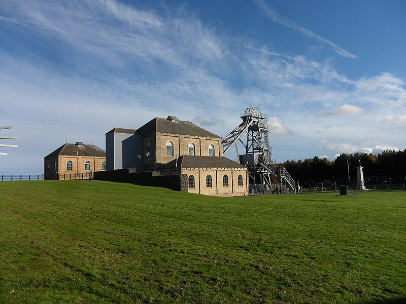
Woodhorn Museum
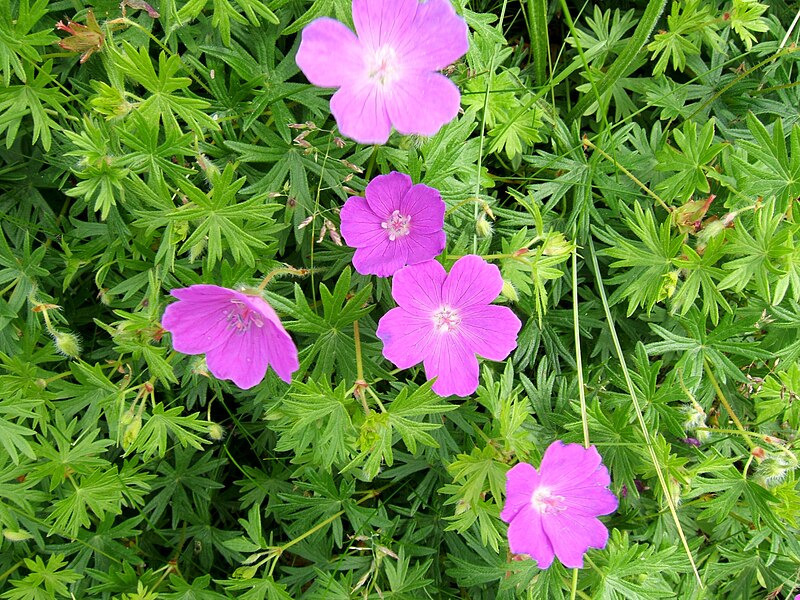
Bloody crane's-bill at Hauxley on the Northumberland coast
Bloody Crane's-bill Geranium sanguineum, Hauxley, Northumberland, UK.
'Wonderful World' 카테고리의 다른 글
| Meteora in Greek (0) | 2025.03.17 |
|---|---|
| # Northumberland, England, UK (0) | 2025.03.16 |
| Brazilian Atlantic Islands-Fernando de Noronha (0) | 2025.03.15 |
| Breathtaking view of the famous Fernando de Noronha (0) | 2025.03.15 |
| 江西弋阳龟峰山风景区 (1) | 2025.03.15 |