2024. 10. 20. 04:04ㆍWonderful World
Pictured Rocks National Lakeshore

Pictured Rocks National Lakeshore pictured Rocks Caves

Beautiful sea cave sunset on Lake Superior near Munising, Michigan and Pictured Rocks National Lakeshore...
Pictured Rocks National Lakeshore, America’s first National Lakeshore, is along the southern shore of Lake Superior in Michigan’s beautiful Upper Peninsula. With stunning beaches, 10 inland lakes, and nearly 100 miles of trails, everyone can find something to enjoy at Pictured Rocks!
No matter the time of year, there is something to do at Pictured Rocks!

Awe-Inspiring Vista: Grant Portal Point
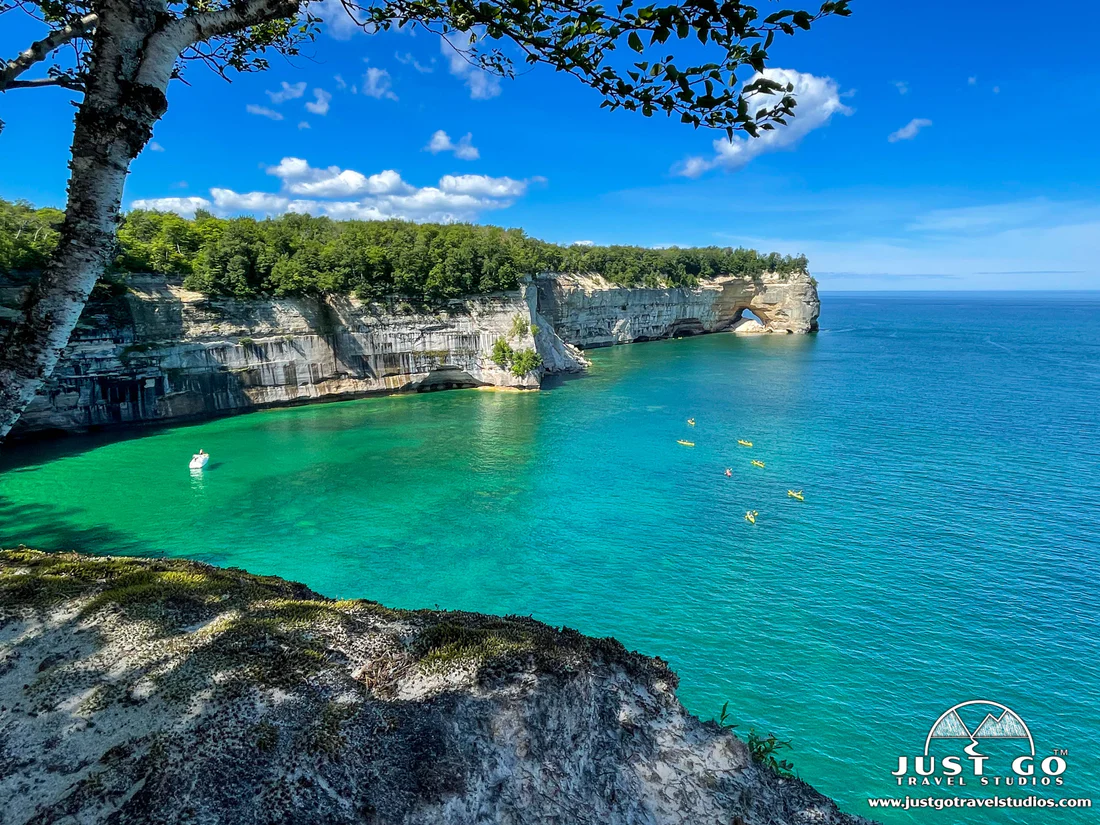
A beautiful sunset is captured at Grand Portal Point.

Pictured Rocks National Lakeshore is located along the southern shore of Lake Superior in the Upper Peninsula of Michigan.
Pictured Rocks National Lakeshore is a U.S. National Lakeshore in the Upper Peninsula of Michigan, United States. It extends for 42 mi (68 km) along the shore of Lake Superior and covers 73,236 acres (114 sq mi; 296 km2). The park has extensive views of the hilly shoreline between Munising and Grand Marais in Alger County, with picturesque rock formations, waterfalls, and sand dunes.

Grand Sable dunes looking towards Lake Superior near Grand Sable Lake.

A picture of the Grand Sable Dunes near Grand Marais Upper Peninsula Michigan.
The Picture was taken facing east.

Rising 300ft above Lake Superior, the Grand Sable Dunes

Grand Sable Dunes

Painted Rocks: Multicolored Sandstone Cliffs
Mineral stain along the Pictured Rocks National Lakeshore.

Picture Rocks Shoreline
Pictured Rocks derives its name from the 13 miles (24 km) of colorful sandstone cliffs northeast of Munising. The cliffs reach up to 200 feet (60 m) above lake level. They have been naturally sculptured into a variety of shallow caves, arches, and formations resembling castle turrets and human profiles. Near Munising, visitors can also visit Grand Island, most of which are included in the separate Grand Island National Recreation Area.
The U.S. Congress designated Pictured Rocks the first National Lakeshore in the United States in 1966. It is governed by the National Park Service (NPS), with 22 year-round NPS employees as of May 2006, and received 1,313,179 visitors in 2021.

The Magic of Spray Falls
View from a Pictured Rocks Cruise of Spray Falls.

A Towering Rock Formation: Miners Castle
Miners Castle, a popular landmark in the Pictured Rocks National Lakeshore

Pictured Rocks Sea Caves


Sea Caves
Geology

Au Sable Light Station
Au Sable Light, built in 1874 after numerous shipwrecks
The colors in the cliffs are created by the large amounts of minerals in the rock. The cliffs are composed of the Munising Formation of 500-million-year-old Cambrian Period sandstone. The Munising Formation sits atop Precambrian sandstone of the Jacobsville Formation. The mottled red Jacobsville Formation is the oldest rock in the park. On top of the Munising Formation, acting as a cap over the other layers is the hard sandstone of the younger Au Train Formation from the Ordovician Period. Streaks on the face of the cliffs come from groundwater leaching out of the rock and evaporating, leaving streaks of iron (red), manganese (black-white), limonite (yellow-brown), copper (pink-green), and other minerals.

The large formations along the Pictured Rocks National Lakeshore

Bridalveil Falls
Bridalveil Falls in Pictured Rocks National Lakeshore.

Bridalveil Falls, Pictured Rocks National Lakeshore

Pictured Rocks in Fall
The East Channel Lighthouse in Fall from the deck of a Pictured Rocks Cruise.

Hidden-Gem Michigan Fall Road Trips

Chapel Rock Pictured Rocks National Lakeshore near Munising Michigan

Chapel Rock
This stunning remnant of Cambrian age sandstone was carved by Lake Nipissing high water some 3,800 years ago and was dubbed Chapel Rock by French explorers. There once was an archway connecting the rock to the mainland, but it collapsed in the 1940s. The lone white pine growing from atop Chapel Rock is estimated to be about 250 years old.


This tree is amazing. There used to be a rock bridge across, but it fell, leaving the tree’s roots exposed but still anchored into the soil on land. This is what keeps this tree alive! There’s no soil for it on the sea stack.

Miners Falls : Pictured-Rocks-Miners-Falls

Miners Falls

Miners Castle Caves

Miners Castle

Pictured Rocks National Lakeshore

Chapel Beach

Grand Island

Pictured-Rocks-National-Lakeshore-Munising-frommarrvantage
Tahquamenon Falls State Park
The second-largest waterfall east of the Mississippi River, visiting Tahquamenon Falls should be on your Upper Peninsula itinerary.

There are actually two falls here, Upper and Lower Tahquamenon Falls.
Upper Tahquamenon is like a mini-Niagara Falls. Lower Tahquamenon is a series of five smaller falls that flow around an island in the river.
'Wonderful World' 카테고리의 다른 글
| Cowiche Canyon Preserve — Washington Trails … (0) | 2024.10.20 |
|---|---|
| San Juan, the capital and largest city of the Argentine province of San Juan (1) | 2024.10.20 |
| Canyonlands National Park Utah (0) | 2024.10.20 |
| Canyonlands National Park in Utah (0) | 2024.10.20 |
| Parque Nacional de São Joaquim ; National park in the state of Santa (0) | 2024.10.20 |