2025. 3. 31. 06:56ㆍWonderful World


Capital City of Windhoek.
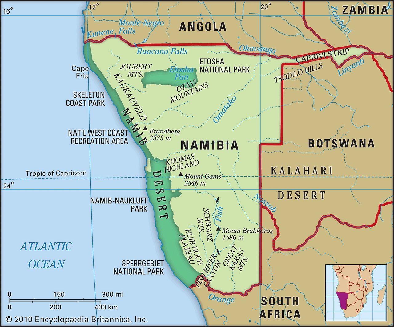
After 106 years of German and South African rule, Namibia became independent on March 21, 1990, under a democratic multiparty constitution. The capital of the country is Windhoek.
Area : 825,615 km2 Population :3,092,816 ( 2025 census)

Capital City of Windhoek.


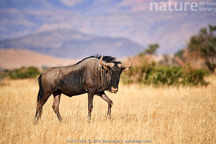
Blue wildebeest (Connochaetes taurinus)

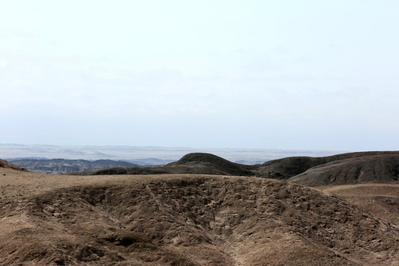
NAMIB-NAUKLUFT NATIONAL PARK – NAMIBIA

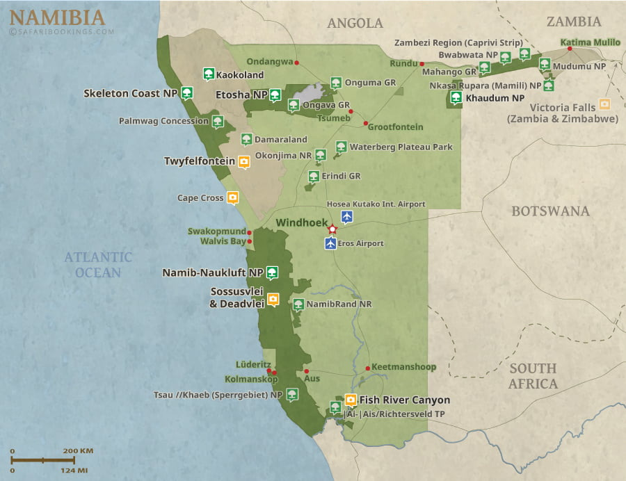
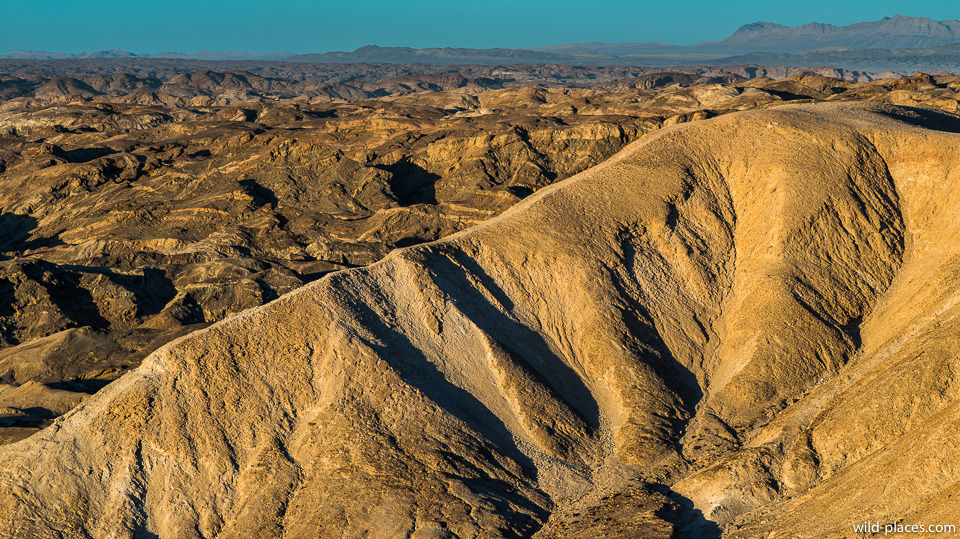
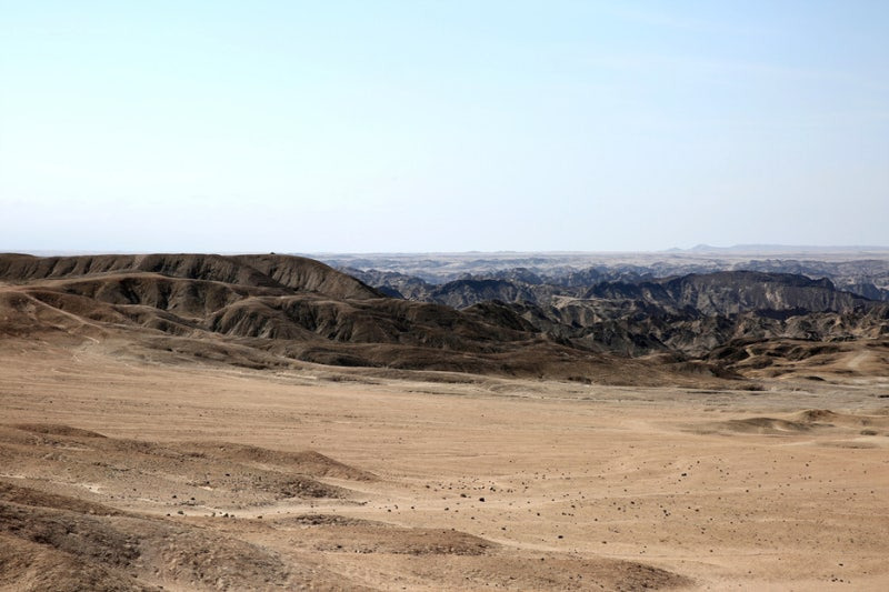
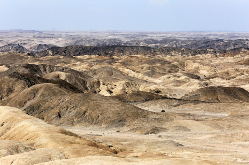
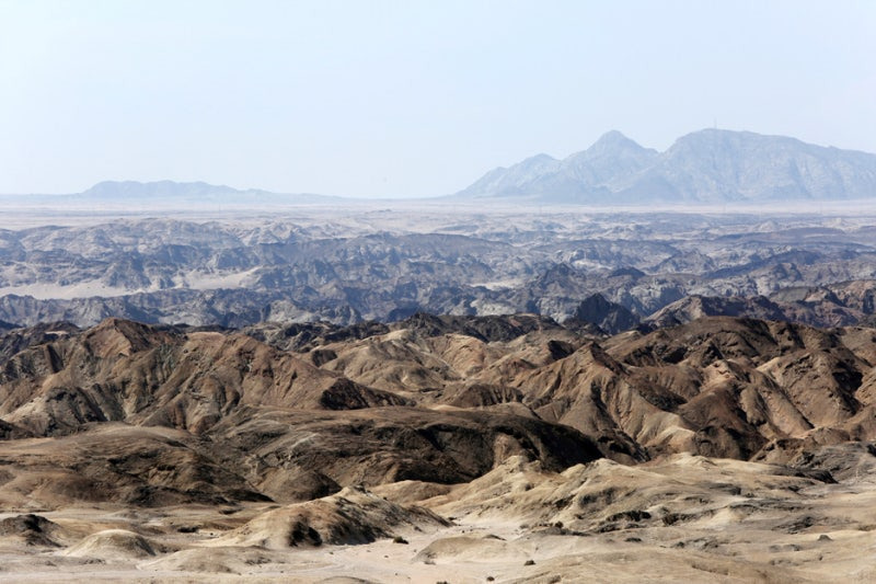
The Namib-Naukluft National Park, is the largest national park in the Republic of Namibia, and includes part of the Namib Desert (considered the world's oldest desert) and the Naukluft mountain range.
With an overall area of 49,768 km², the Namib-Naukluft is the largest game park in Africa, and the fourth largest in the world.
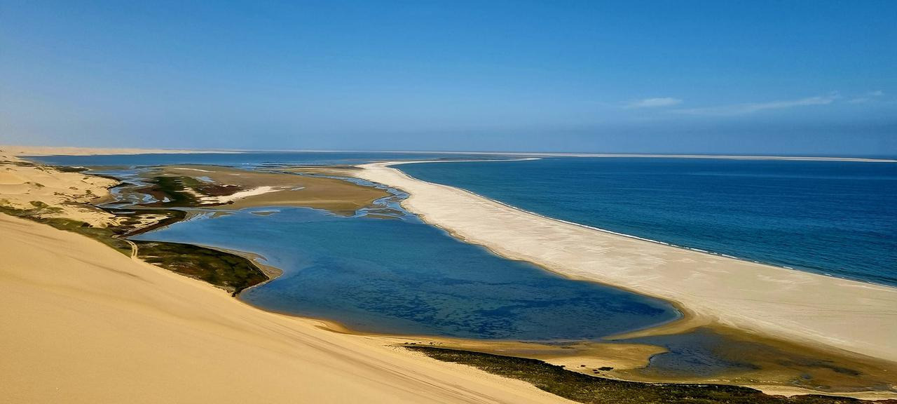
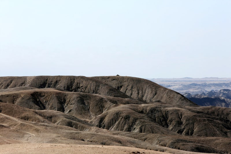
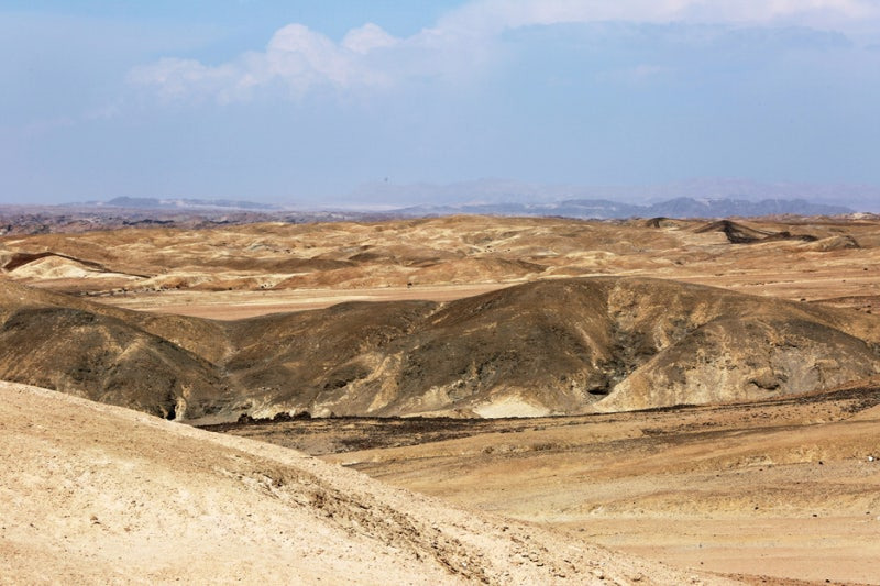
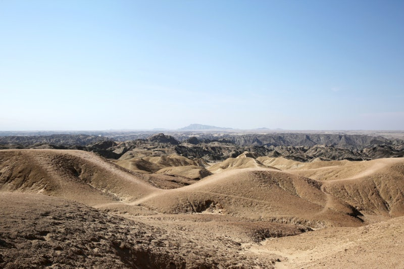
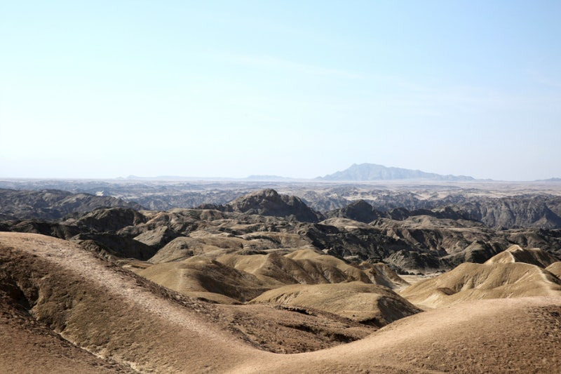
Moon Valley, Swakopmund, Namibia
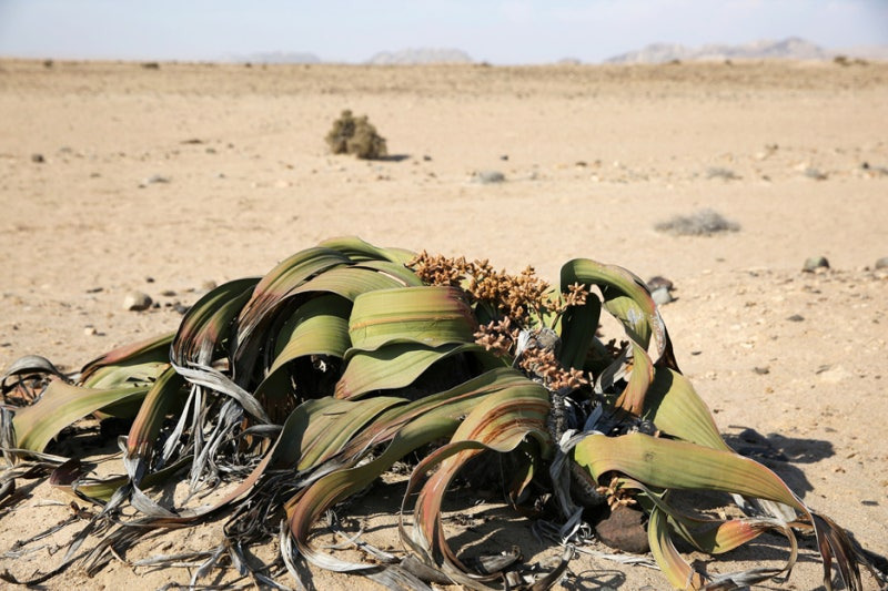
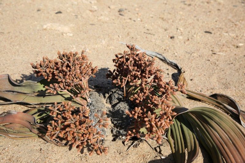
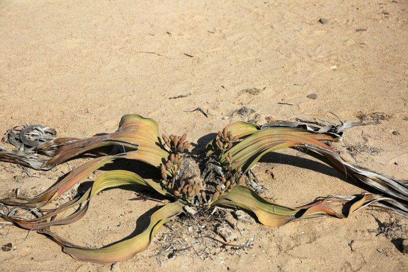
The "Moon Valley" or "Moon Landscape" near Swakopmund in Namibia, part of the Namib-Naukluft National Park, is a stunning, lunar-like landscape where you can find the unique Welwitschia mirabilis plant, known for its long lifespan and distinctive leaves.
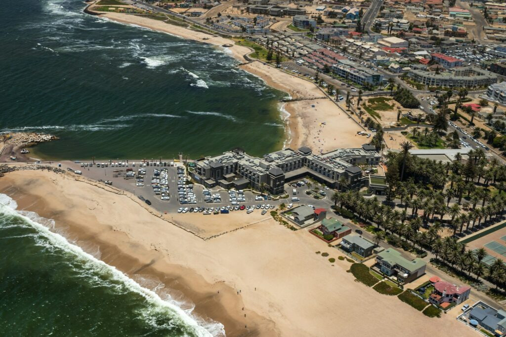
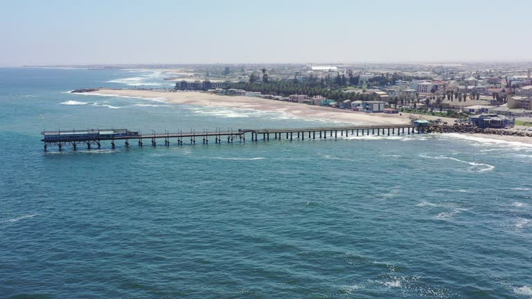
나미비아 스와콥문트(Swakopmund)와 왈비스베이(Walvis Bay)는 사람, 사막, 바다가 공존하는 곳으로 쉽게 접하지 못한 자연환경을 볼 수 있어 많은 관광객들이 이곳을 찾는다.
스바코프문트에서 멀리 떨어지지 않은 곳에 위치해 있는 달의 계곡문밸리(moon valley)와 메마르고 척박한 땅 사막에서 천년이 넘는 질긴 생명력으로 살아 있는 화석이라 불리는 ‘벨비치아(Welwitchia)'를 만나 볼 수 있다.
문 밸리(moon valley)는 사구로 이루어진 사막이 아니라 화산활동으로 형성된 암석 지형이다. 마치 달에 온 듯한 기분이 드는 곳인데 그 모양 때문에 문 밸리라는 이름이 붙었다고도 한다.
영국과 독일의 식민지 거래 그리고 세계에서 가장 큰 빅토리아 호수
https://www.youtube.com/shorts/LGGCEJjewg4
나미비아(Namibia)아프리카 서남부 대서양 연안에 있는 공화국.
정식 명칭은 나미비아공화국(Republic of Namibia)으로, 대서양 연안의 해안선이 1489㎞에 이른다. 면적은 82만 4292㎦, 인구는 221만 2307명(2015년 현재)이며, 수도는 빈트훅(Windhoek)이다.
나미비아는 영토의 중앙을 나마콸란드(Namaqualand)로 불리는 해발고도 1,000 ~ 2,000m의 고원이 남북으로 길게 뻗으며 대부분의 지역을 덮고 있고, 고원 서쪽에 폭 80 ~ 120km의 좁은 '나미브 모래바다'로 불리는 사막지대 해안을 따라 남북으로 이어진다. 고원 동쪽으로는 칼라하리 사막이 있다.
북쪽 앙골라와의 국경선을 따라 쿠네네 강과 오카방고 강이, 중서부 빈트후크 인근 코마스 고원에서 발원한 노소브 강이 흐른다. 남쪽 남아프리카공화국과의 국경선을 따라 오렌지 강이 흐른다. 기후는 사막기후로서 밤·낮의 온도차가 크고, 매우 건조하며 전 지역이 거의 사막 또는 스텝이다. 해안저지(低地)는 북상하는 벵겔라 한류(寒流)의 영향으로 한랭하고 안개가 많다. 강우량이 적고 일정하지 않아 가뭄이 잦다.
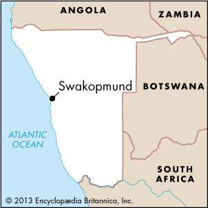
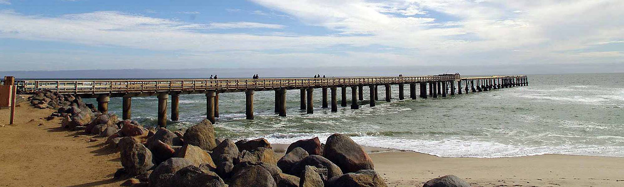
Swakopmund is a popular resort town in Namibia. It is located where the Swakop River empties into the Atlantic Ocean, 20 miles (32 kilometers) north of Walvis Bay. German-style architecture gives the city an atmosphere similar to that of a traditional German town.
Swakopmund has a milder climate than most of Namibia. However, the area is subject to sandstorms when the wind blows from the east. During winter, Swakopmund is known for the fog that rolls in from the Atlantic Ocean. Foggy nights are often cold.
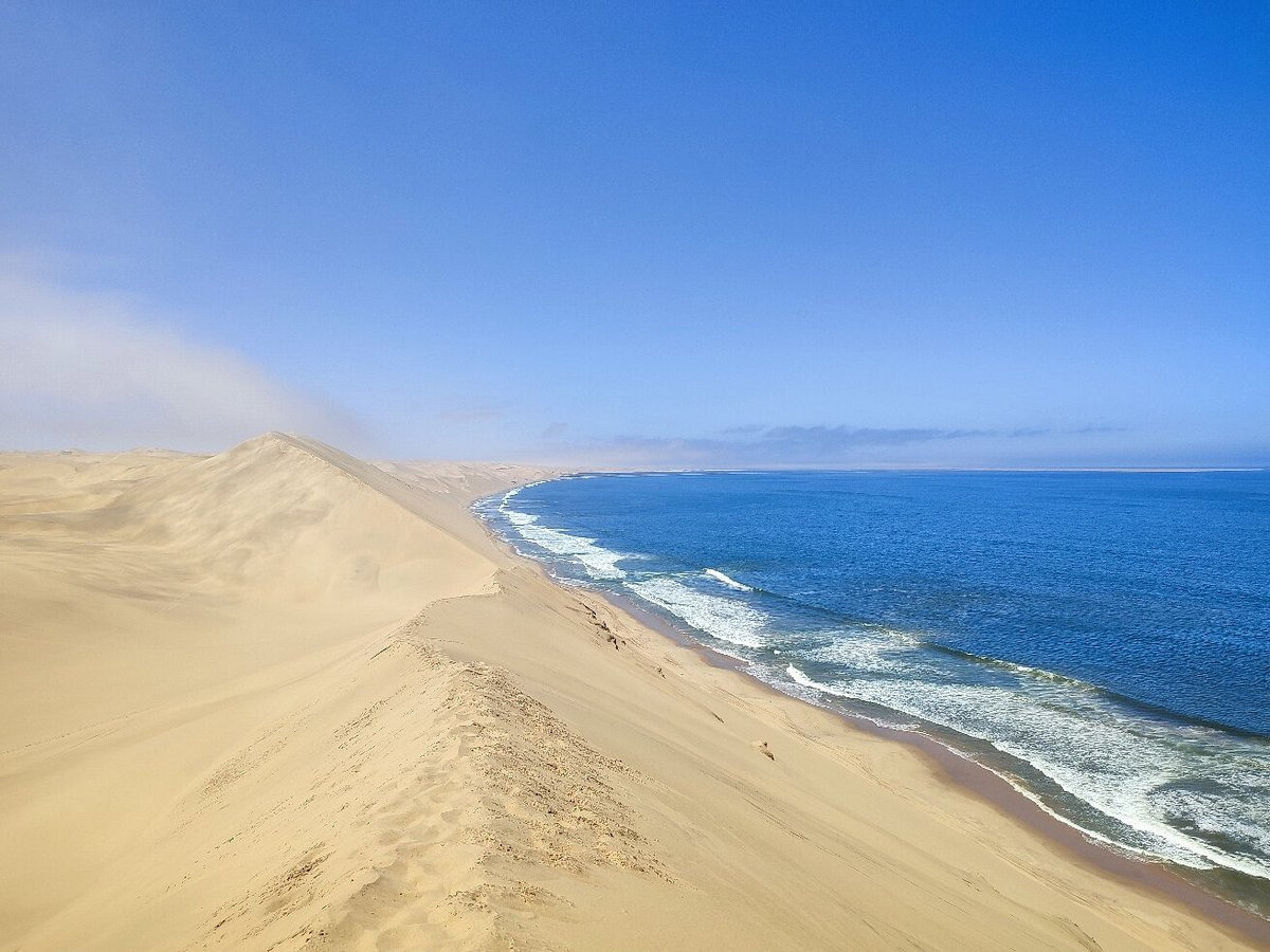
남아프리카 나미비아, 달의 계곡(moon valley)과 벨비치아(Welwitchia)
The "Moon Valley" and "Welwitschia Plains"
are located in the Namib-Naukluft National Park, near Swakopmund, Namibia, and offer a unique experience of a lunar-like landscape and the chance to see the ancient Welwitschia mirabilis plant.
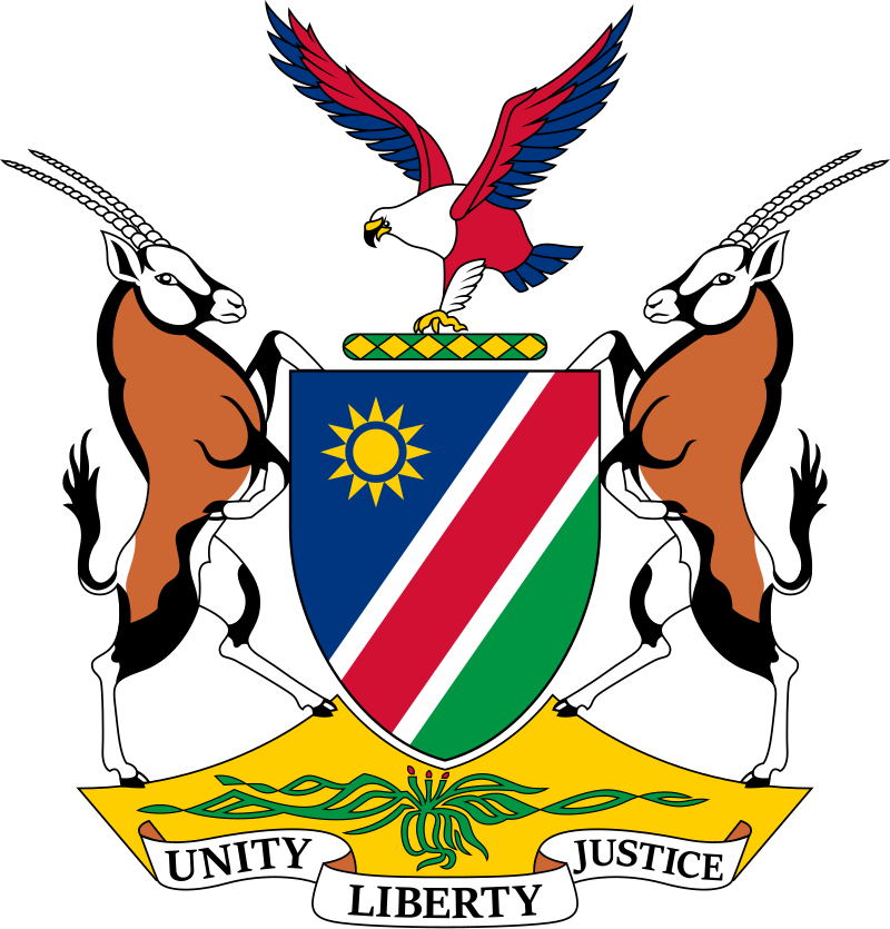
Coat of Arms of Namibia, with a Welwitschia in the bottom
Heraldry
The plant figures in the compartment of the national coat of arms of Namibia.
* 문장(紋章, heraldry) 문장학(紋章學, heraldry)
-'크레스트(crest)', '엠블럼(emblem)', '실(seal)', '코트 오브 암즈(coat of arms)'
-나라의 문장은 국장(國章)
'Wonderful World' 카테고리의 다른 글
| Earth’s Last Untouched...North Sentinal Island (0) | 2025.03.31 |
|---|---|
| Moon Valley and Welwitschia, Swakopmund, Namibia (0) | 2025.03.31 |
| Tepui (or Tepuy) Mountains : Venezuela, Brazil, Guyana, Suriname (0) | 2025.03.31 |
| Earth’s Last Untouched Paradises 2 (0) | 2025.03.31 |
| Earth’s Last Untouched Paradises 1 (0) | 2025.03.30 |