2024. 6. 30. 08:03ㆍWonderful World
Tenerife, Canary Islands, Spain.

카나리아(Canary)는 스페인어(Canarias)로 'can (개) + arias (땅)'이라는 뜻이다.
-같은 맥락으로 Gran Canarias는 큰 개들의 땅.
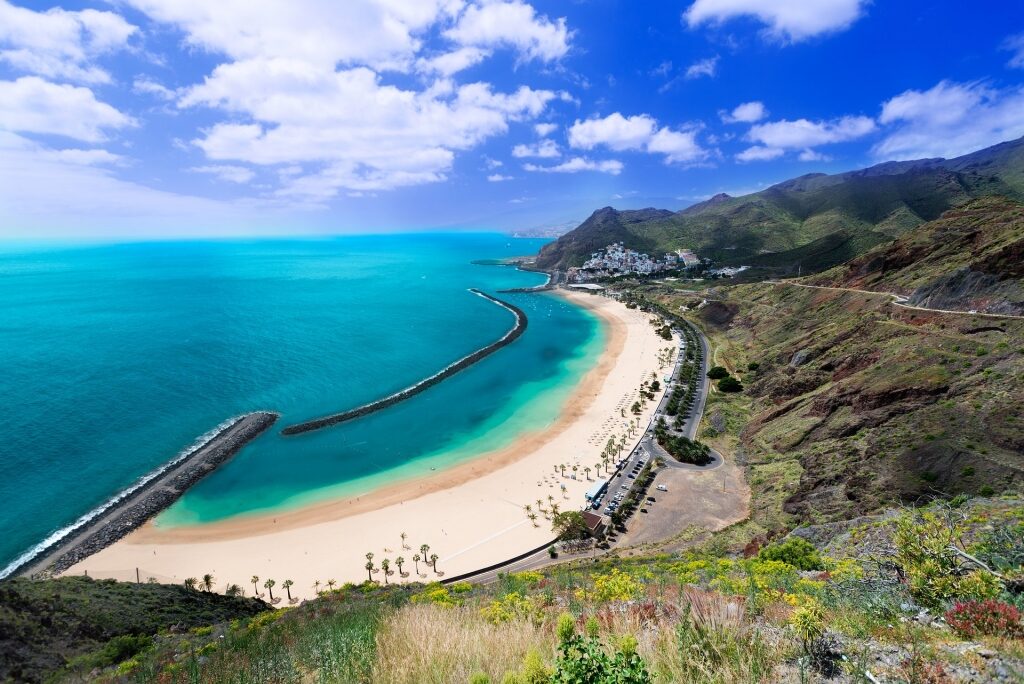
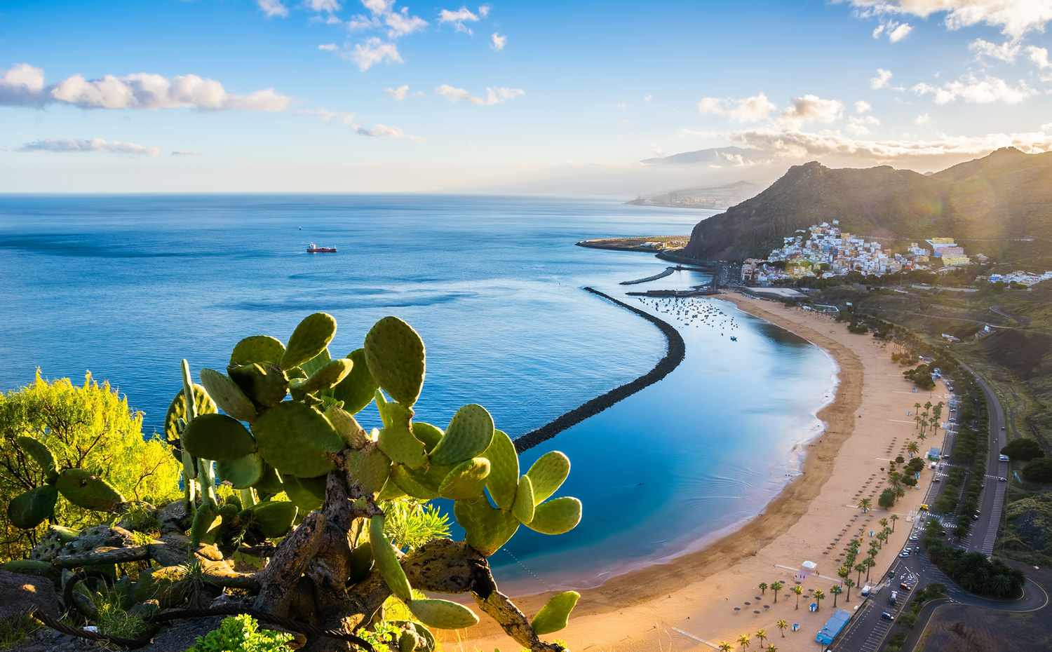
카나리아 제도의 주요 섬 7개 중 가장 큰 테네리페는 해변과 테이데산 정상에 있는 활화산의 극적인 경치로 관광객들에게 큰 인기를 얻는다. 테이데 국립공원은 2007년 유네스코 세계 문화유산으로 지정되었다.
스페인에서 가장 높은 산인 테이데를 품은 이 국립공원에서는 천문 관측과 하이킹 등 다양한 활동을 할 수 있다.
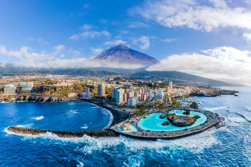
aerial-view-puerto-de-la-cruz-tenerife
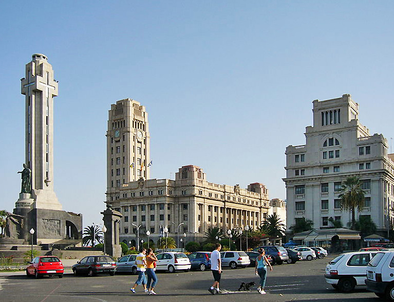
Architecture in Santa Cruz (Plaza de España)
View of Island Palace, Santa Cruz de Tenerife, Tenerife (Canary Islands, Spain).
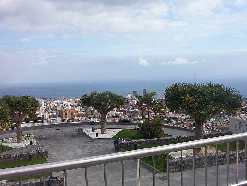
Santa Cruz de Tenerife
카나리아(스페인어로는 Canarias)라는 단어는 스페인어로 'can (개) + arias (땅)'이라는 뜻이다. 같은 맥락으로 Gran Canarias는 큰 개들의 땅.

대서양에 있는 군도로, 북서아프리카 본토에서 108㎞ 이상 떨어져 있다.
스페인 본토에서는 1,400~2,200㎞ 거리로,

Map of Tenerife
테네리페섬(Tenelife Island)
카나리아 제도에 포함되는 테네리페 섬의 최대도시이자 라스팔마스(Las Palmas)와 더불어 카나리아 지방의 공동 주도이다.
Tenerife (/ˌtɛnəˈriːf/ TEN-ə-REEF; Spanish: [teneˈɾife]; formerly spelled Teneriffe) is the largest and most populous island of the Canary Islands. It is home to 42.9% of the total population of the archipelago. With a land area of 2,034.38 square kilometres (785.48 sq mi) and a population of 948,815 inhabitants as of January 2023, it is also the most populous island of Spain and of Macaronesia.
Approximately five million tourists visit Tenerife each year; it is the most visited island in the archipelago.[8] It is one of the most important tourist destinations in Spain and the world, hosting one of the world's largest carnivals, the Carnival of Santa Cruz de Tenerife.
The capital of the island, Santa Cruz de Tenerife, is also the seat of the island council (cabildo insular). That city and Las Palmas de Gran Canaria are the co-capitals of the autonomous community of the Canary Islands. The two cities are both home to governmental institutions, such as the offices of the presidency and the ministries.
This has been the arrangement since 1927, when the Crown ordered it. (After the 1833 territorial division of Spain, until 1927, Santa Cruz de Tenerife was the sole capital of the Canary Islands). Santa Cruz contains the modern Auditorio de Tenerife, the architectural symbol of the Canary Islands.
The island is home to the University of La Laguna. Founded in 1792 in San Cristóbal de La Laguna, it is the oldest university in the Canaries. The city of La Laguna is a UNESCO World Heritage Site. It is the second most populous city on the island, and the third most populous in the archipelago. It was the capital of the Canary Islands before Santa Cruz replaced it in 1833. Tenerife is served by two airports; Tenerife North Airport and Tenerife South Airport.
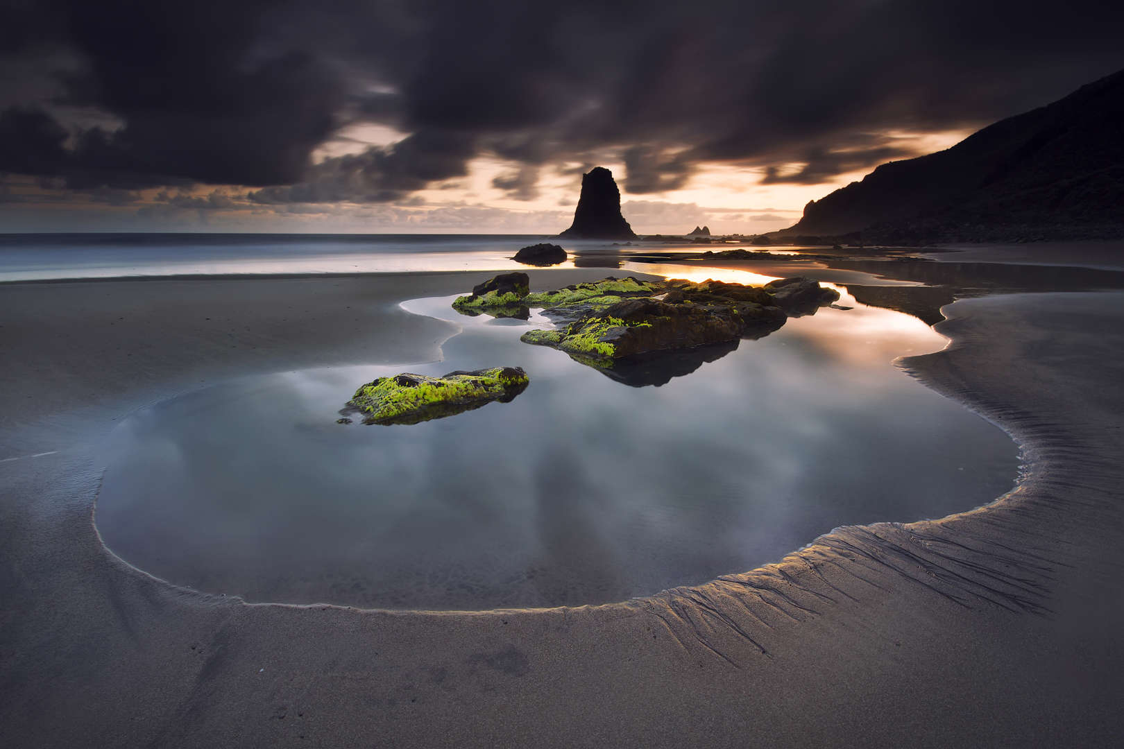
Teide National Park, located in the center of the island, is also a UNESCO World Heritage Site. It includes Mount Teide, which has the highest elevation in Spain, and the highest elevation among all the islands in the Atlantic Ocean. It is also the third-largest volcano in the world, when measured from its base.[16] Another geographical feature of the island, the Macizo de Anaga (massif), has been designated as a UNESCO Biosphere Reserve since 2015. Tenerife also has the largest number of endemic species in Europe.

This image acquired by one of the Copernicus Sentinel-2 satellites on 30 April 2023 shows the Canary Islands, a Spanish archipelago located off the coast of northwest Africa and renowned for its unique ecosystems and stunning natural beauty. The Canary Islands are now facing the dire consequences of climate change, including rising sea levels, extreme weather events, and the potential displacement of local communities.
If current climate change trends are to continue, the archipelago could lose half of its beaches and 10% of its housing. Considering these challenges, the local administration is calling for greater control over the islands’ governance and decision-making processes. It argues that increased autonomy would provide it with the necessary tools and resources to implement effective measures to mitigate the effects of climate change and safeguard the future of local communities.
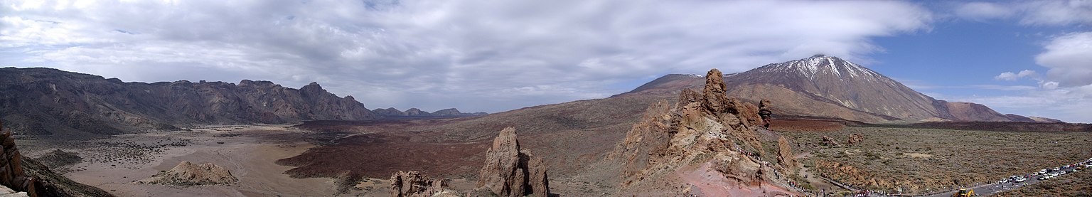
Panorama of Teide National Park
Panorama des Pico de Teide auf Teneriffa
Imagen_sintética_de_Tenerife
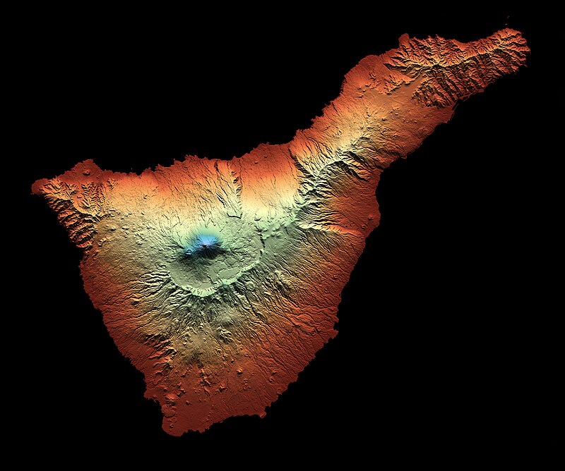
Altitude map of Tenerife, with the highest altitude (Mount Teide) in blue and the lowest (sea level) in black
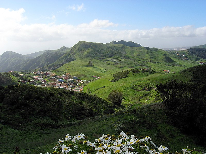
The uneven contours of the Anaga massif
The Anaga massif (Macizo de Anaga), at the northeastern end of the island, has an irregular and rugged topographical profile where, despite its generally modest elevations, the Cruz de Taborno reaches a height of 1,024 metres (3,360 feet).
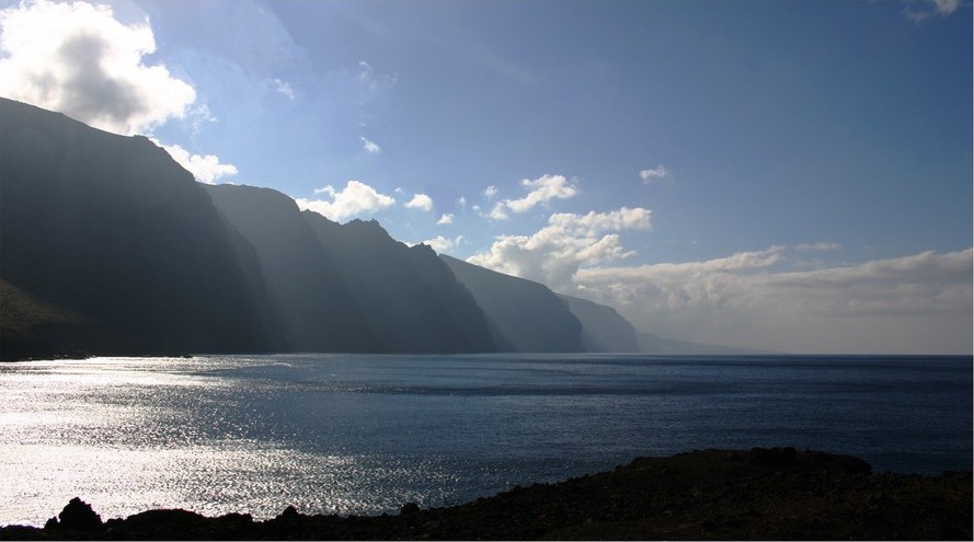
Teno massif (Macizo de Teno) —Cliffs of the Giants area
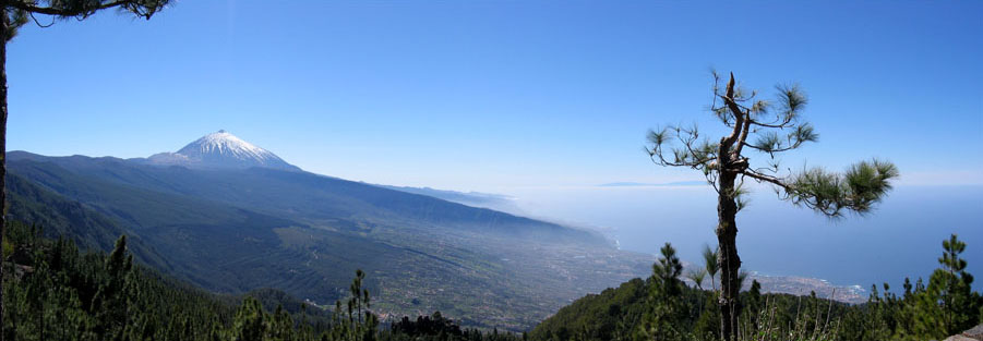
Panorama of the La Orotava Valley with Teide in the background.

Panorama of Valle de La Orotava
The most important are Valle de La Orotava and Valle de Güímar, both formed by the mass sliding of great quantities of material towards the sea, creating a depression of the land.

Forested areas populated by Pinus in El Chinyero Special Nature Reserve
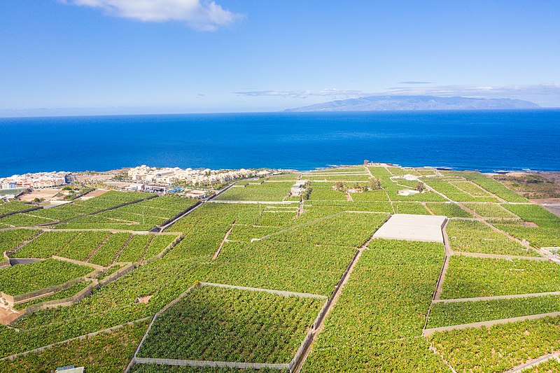
Banana plantations in the western coastline (Guía de Isora)

(September 7) Annual performance to honour Our Lady of Candelaria at Socorro Beach, Güímar, Tenerife, Canary Islands, Spain. It conmmemorates a Marian apparition: According to a legend recorded by Alonso de Espinosa in 1594, the image of Our Lady of Candelaria appeared before Guanche shepperds around 1400, before the Castilian conquest of the island, hence the fur capes
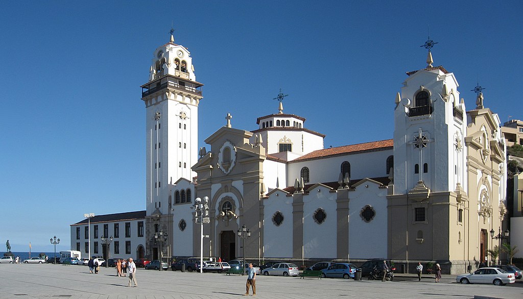
Tenerife.candelaria.exterior.basilica
Basilica of Candelaria, sanctuary of the Virgin of Candelaria, patron saint of the Canary Islands
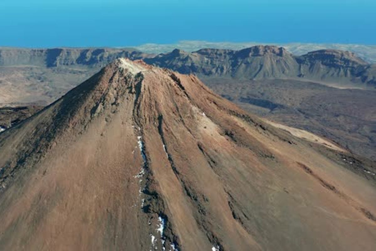
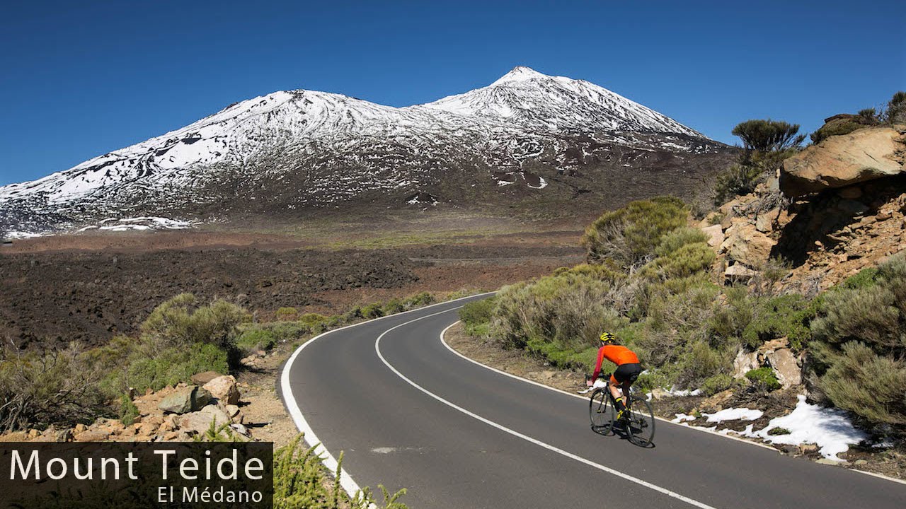
섬 중앙에 솟아 있는 활화산 테이데(Teide)는 스페인에서 가장 높은 봉우리이자 전 세계에서 세 번째로 높은 활화산으로, 높이 3,715미터에 이른다. 활화산을 둘러싼 테이데국립공원(Teide National Park)은 유네스코 세계문화산에 지정돼 있다.

Teide Peak on Tenerife, Canary Islands, Spain.
The remaining two-thirds of Tenerife is a vast composite dome surmounted by Teide Peak, the highest point on Spanish soil (12,198 feet [3,718 metres]).

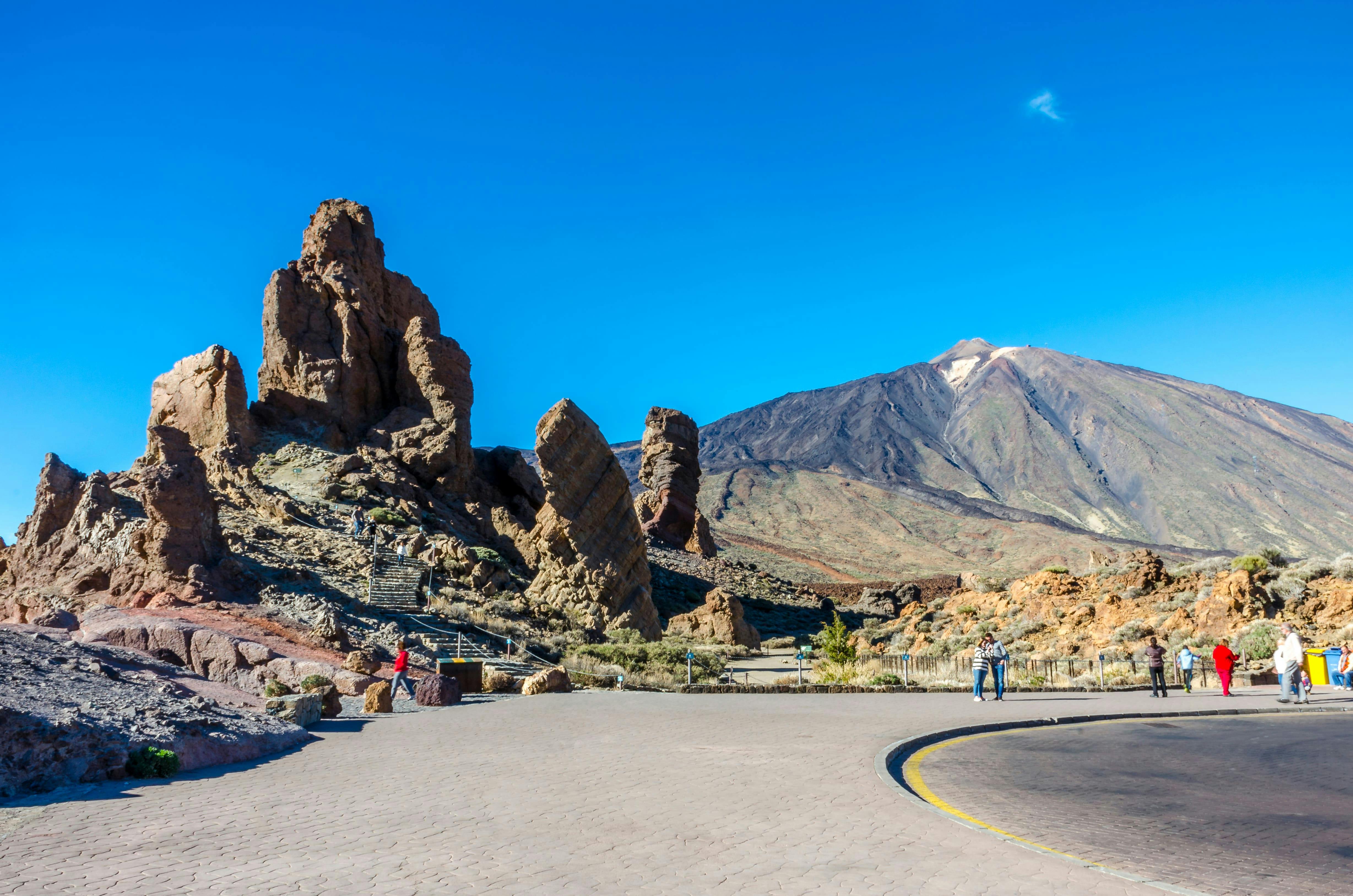
Teide and Roque Cinchado.

Tenerife
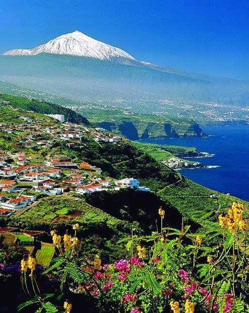
Teide with snow, Tenerife, Canary Islands, Spain

'Wonderful World' 카테고리의 다른 글
| Majestic mountains around the world 1 (0) | 2024.07.06 |
|---|---|
| Majestic mountains around the world 2 (0) | 2024.07.06 |
| Islas Canarias Canary Islands (1) | 2024.06.30 |
| 立山連峰[ たてやまれんぽう] (1) | 2024.06.10 |
| 立山連峰の風景 と 「立山連峰」 映画の主題歌 (0) | 2024.06.10 |